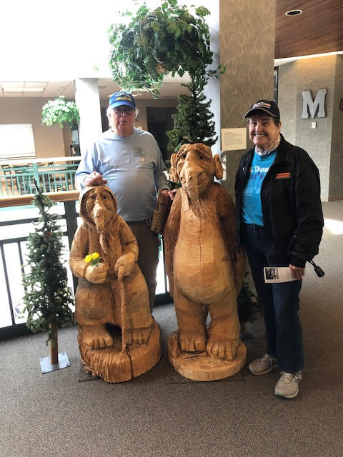
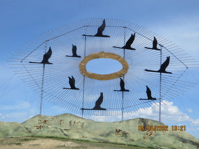
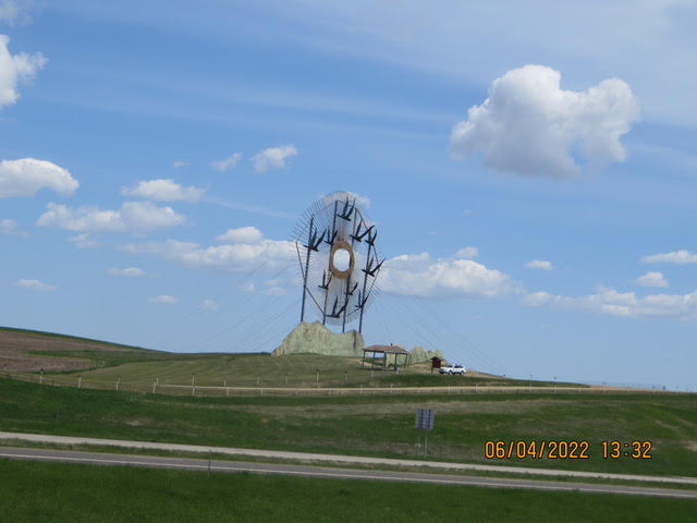
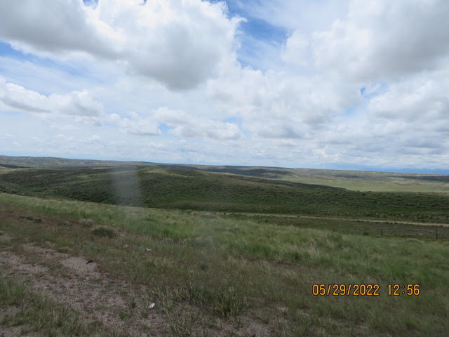
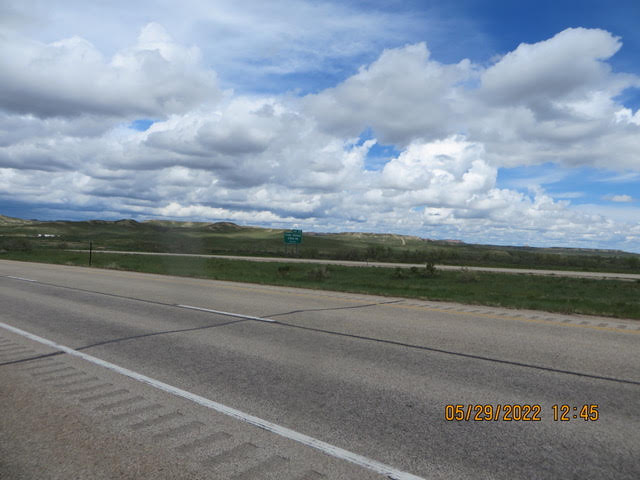
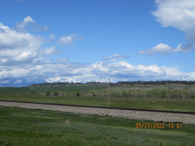
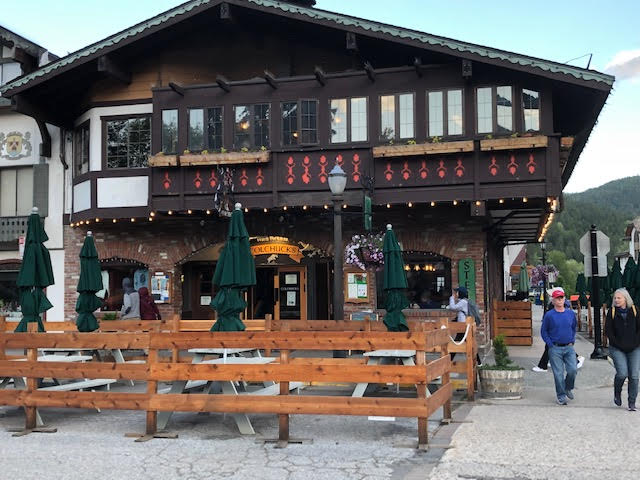
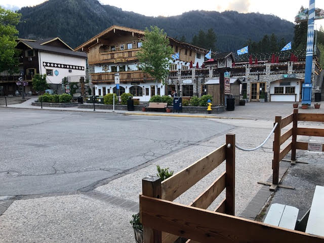
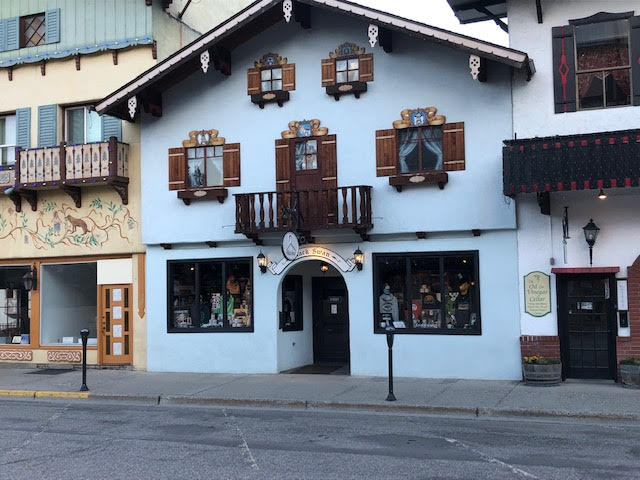
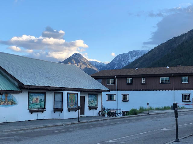
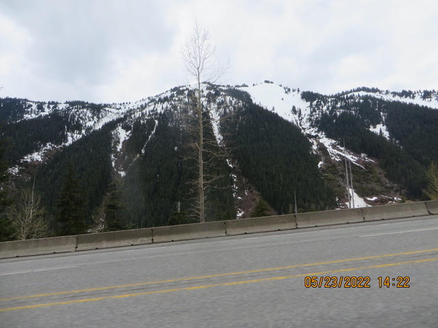
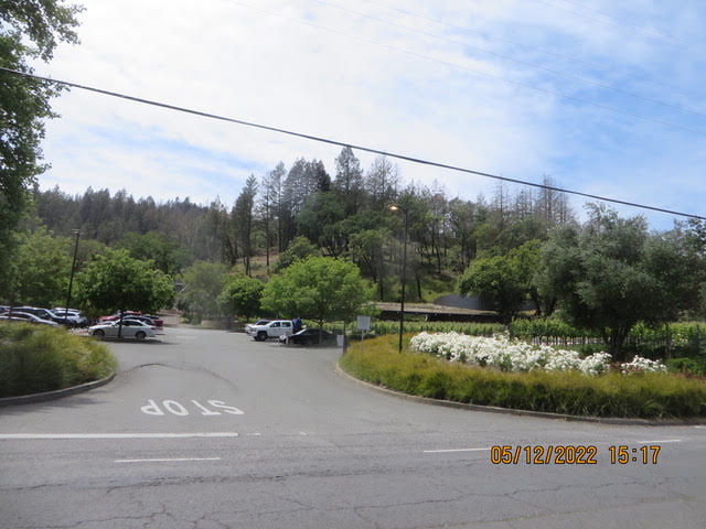
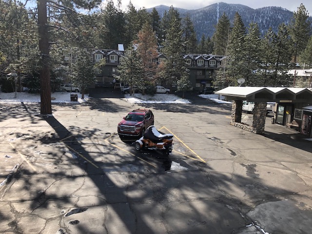
6/15/22 – Everything is normal in Normal, Illinois
Hello from the land of Lincoln,
As you can guess we are in Normal IL tonight after surviving a hot mid-America day.
Normal is a town in McLean County, Illinois, United States. As of the 2020 census, the town’s population was 52,736. Normal is the smaller of two principal municipalities of the Bloomington–Normalmetropolitan area, and Illinois’ seventh most populous community outside the Chicago metropolitan area. As of 2022, Chris Koos has been Normal’s mayor since 2003.
The main campus of Illinois’ oldest public university, Illinois State University, a fully accredited four-year institution, is in Normal, as is Heartland Community College, a fully accredited two-year institution. There is also a satellite campus of Lincoln College, which offers associate degrees as well as four-year programs.
The town was laid out with the name North Bloomington on June 7, 1854 by Joseph Parkinson. From its founding, it was generally recognized that Jesse W. Fell was the force behind the creation of the town. He had arranged for the new railroad, which would soon become the Chicago and Alton Railroad, to pass west of Bloomington then curving to cross the Illinois Central Railroad at a point where he owned or controlled land. Most of the original town lies south of these tracks, with Beaufort Street as its northern limit, and some blocks west of the Illinois Central and north of the tracks.Fell, his brothers, and associates quickly laid out many additions to the original town.
The town was renamed Normal in February 1865 and officially incorporated on February 25, 1867. The name was taken from Illinois State Normal University, a normal school (teacher-training institution) located there. The school has since been renamed Illinois State University after becoming a general four-year university. Normal is adjacent to Bloomington, Illinois, and when mentioned together they are known as the “Twin Cities”, “Bloomington-Normal“, “BN”, or “BloNo”.
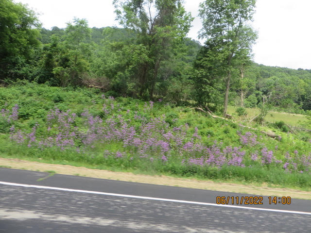
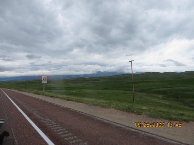
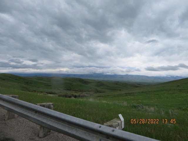
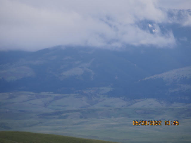
Any one who has lived in the mid west in the summer will recognizer this description, hot and hazy. There was a haze on the horizon that just hung there, the wind was blowing but, the haze was just there. We left earlier than other days just to beat the heat a just little bit.
I had Karen scanning the skies for funnel clouds, none observed. If Karen spotted one we were going to give chase. The storms were north of us in Wisconsin.
In North Dakota it was fields and fields of wheat, here it is corn and soy beans everywhere. I wonder how much of the corn is grown for ethanol.
Tomorrow we continue our journey south. Hopefully, the heat dome will lift. Rain is expected over night.
No pictures today .
We continue bore on through the heat.
6/14/22 – Madison WI, Under the heat dome
Hello everyone,
Under a heat dome,we’re under the heat dome for sure. The Spyder wants to use the summer protocol, start early and end when it’s hot. That is the exact opposite of our cold protocol. We will be on the road early in the morning probably every day till we get home. Earlier in the trip I think we were under an igloo.
There is not a lot to comment about today, just heading south on I-94. It will be all Interstate highway now, no plans to do any sightseeing unless, you never know what will pop up. See Rock City, hmm…
Short and sweet like kissing your brother or sister
John and Karen
6/13/22 – Rained in, in Osseo Wi
Hello from the water bound Stahl’s
The Spyder didn’t want wake up today. He just wanted to sleep and wait out the rain. I don’t think he can log on the MY Radar app but, it rained all day, thunder and lightening.
Karen and I got out the rain gear but when looking at the radar we decided to spend an additional day in Osseo WI.
A good day to do laundry and an afternoon nap. I worked on saving the emails to a external hard drive
The rain should end in the late afternoon then we can walk over to the Osseo Family Restaurant..
We ate there last night and were stuffed. It seems like the serving size has increased over several years. Our server said customers will order one meal and ask for a second plate and split meal. That would have worked for us. If we were home we would take half home for lunch tomorrow.
Last nights dinner was roast pork, dressing, mashed potatoes and corn. We ate all the meat and part of the rest. Tonights dinner ?
Osseo is a city located in Trempealeau County, Wisconsin, at the confluence of the North and South Forks of the Buffalo River. The population was 1,701 at the 2010 census.
Settled in 1857, Osseo is rich in it’s heritage and ethnic culture, and is a picturesque city nestled in the rolling hills of northeastern Trempealeau County. The Scandinavian “flare” is plainly seen today in it’s annual “Lake Martha Days” celebration and throughout the city shops and businesses. Osseo became a city in 1941 and is governed by a mayor an common council.
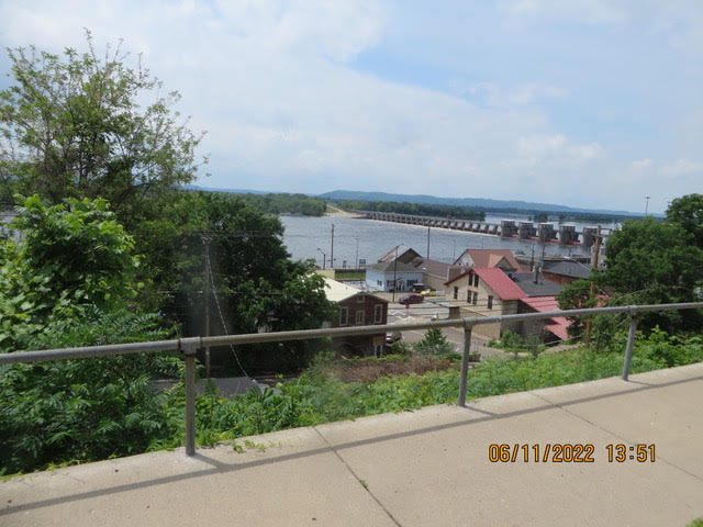
La Crosse is a city in the U.S. state of Wisconsin and the county seat of La Crosse County. Positioned alongside the Mississippi River, La Crosse is the largest city on Wisconsin’s western border. La Crosse’s population as of the 2020 census was 52,680. The city forms the core of and is the principal city in the La Crosse Metropolitan Area, which includes all of La Crosse County and Houston County, Minnesota, with a population of 139,627.
A regional technology, medical, education, manufacturing, and transportation hub, companies based in the La Crosse area include Organic Valley, Logistics Health Incorporated, Kwik Trip, La Crosse Technology, City Brewing Company, and Trane.
The first Europeans to see the region were French fur traders who traveled the Mississippi River in the late 17th century. There is no written record of any visit to the site until 1805, when Lt. Zebulon Pike mounted an expedition up the Mississippi River for the United States. Pike recorded the location’s name as “Prairie La Crosse”. The name originated from the game with sticks that resembled a bishop’s crozier or la crosse in French, which was played by Native Americans there.
The first white settlement at La Crosse occurred in 1841 when Nathan Myrick, a New York native, moved to the village at Prairie du Chien, Wisconsin to work in the fur trade. Myrick was disappointed to find that because many fur traders were already well-entrenched there, there were no openings for him in the trade. As a result, he decided to establish a trading post upriver at the then still unsettled site of Prairie La Crosse. In 1841, he built a temporary trading post on Barron Island (now called Pettibone Park), which lies just west of La Crosse’s present downtown. The following year, Myrick relocated the post to the mainland prairie, partnering with H. J. B. Miller to run the outfit.
The spot Myrick chose to build his trading post proved ideal for settlement. It was near the junction of the Black, La Crosse, and Mississippi Rivers. In addition, the post was built at one of the few points along the Wisconsin side of the Mississippi River where a broad plain ideal for development existed between the river’s bank and the tall bluffs that line the river valley. Because of these advantages, a small village grew around Myrick’s trading post in the 1840s.
A small Mormon community settled at La Crosse in 1844, building several dozen cabins a few miles south of Myrick’s post. Although these settlers relocated away from the Midwest after just a year, the land they occupied near La Crosse continues to bear the name Mormon Coulee. On June 23, 1850, Father James Lloyd Breck of the Episcopal Church said the first Christian liturgy on top of Grandad Bluff. Today a monument to that event stands atop the bluff, near the parking lot at a scenic overlook.
There are no pictures today unless you want to see raindrops.
Tomorrow we head south toward Beloit WI, hopefully to visit friends from out church in Coral Springs.
6/12/22 – A Backtracking Day
Hello everyone,
That may sound like an unusual title but, it is correct.
Unfortunately it is correct. Yesterday we arrived in Lacrosse WI did our usual routine, stop at McDonalds use their free WiFi take out the laptop and make a hotel reservation. Well opening the the front trunk…. O Shit…the laptop wasn’t there it was at the hotel in Hudson WI, 130 miles behind us.
Hence, no email last night.
Today the Spyder turned around and headed back north following the west bank of “Big Muddy”. The ride was very nice overlooking the the Mississippi River. We came south along the was bank of the river. You can see more of the river on the west side. The east bank has more small towns on the river.
Yesterday we had lunch at the Red Ram Saloon in Alma WI. We had a fine lunch and a good conversation with waiter about his motorcycle experiences as well as ours. It was his Harley out front.


We passed through several interesting small towns along the river each having it own character. Many were planning their summer festivals and art and craft shows. The Great River Road is a beautiful route following the Mississippi River. The River was high and flooded the marsh land along it. There was little barge traffic on the river where we were. I imagine that the traffic will increase in fall when the grain and soy beans are harvested.
We are spending the night in Osseo WI on our way to Beloit WI. Today was probably the longest ride of the road trip, about 230 miles. It will be on interstate tomorrow. Set the cruse at 65 and just roll along. I could easily run 70 but, it’s a road trip.
We might make it home in a week depending on the weather or a sight seeing stop.
6/10/22 – Hudson Wisconsin
Hello everyone,
The Spyder is resting in Hudson WI.
We wanted to visit a friend who moved back to MN but, we could not meet up because, I thought they lived in the Minneapolis but, I found out the lived in Duluth. Of course I did not find that out till after we left Duluth. I guess we will have to go back to Duluth next year.
The Spyder is going to travel the Great River Road south eventually arriving in Beloit to visit long time friends. Here, the Great River Road follows the east bank of Mississippi river. We will follow it to Lacrosse WI and maybe beyond.
We probably saw at least a dozen dead deer along the highway today.
This is farming country. I saw some of the longest pivot irrigators along the way. We followed Route 53 out of Duluth to Eau Claire then west to Minneapolis area.
Eau Claire is known regionally for its arts and music scenes and is the hometown of indie folk band Bon Iver, whose lead singer Justin Vernon co-curates the city’s annual Eaux Claires Music & Arts Festival. Eau Claire is the second fastest-growing major city in Wisconsin after Madison, with 5.4% population growth between 2010 and 2020.
Hudson is a city in St. Croix County, Wisconsin, United States. As of the 2010 United States census, its population was 12,719. It is part of the Minneapolis–St. Paul Metropolitan Statistical Area (MSA). The village of North Hudson is located directly to the north of Hudson.
Hudson was settled in the summer of 1840 by Louis Massey and his brother in-law, Peter Bouchea. William Streets arrived at about the same time. Later that same year, Joseph Sauperson (commonly known as Joe LaGrue) took up residence. These four are considered Hudson’s original inhabitants. Massey and Bouchea settled at the mouth of the Willow River, near the present-day First and St. Croix Streets. They had been part of the group who lived for some time along the river below Fort Snelling, which appears on some old maps as “Massey’s Landing”.
Hudson was originally called Willow River. It was later named Buena Vista by Judge Joel Foster, founder of River Falls, after returning from the Mexican War where he fought in the Battle of Buena Vista. In 1852, Alfred D. Gray, Hudson’s first mayor, petitioned to change the name of the city to “Hudson”, because the bluffs along the St. Croix Riverreminded him of the Hudson River in his native New York.
A large number of settlers arrived in the 1850s and 1860s, many of whom were ancestors of today’s residents. The lumber industry was the prime attraction of the area, and over time sawmills were established throughout the St. CroixValley.
The Chicago, St. Paul, Minneapolis and Omaha Railway was formed in 1881 from other railroads building between the Twin Cities and Chicago. The shops and headquarters of the Omaha Road were located in Hudson. This route is now part of the Union Pacific Railroad.
I don’t know how far we will travel tomorrow. The Great River Road is certainly nota high speed road. There will be multiple picture stops.
The Great River Road is a collection of state and local roads that follow the course of the Mississippi Riverthrough ten states of the United States. They are Minnesota, Wisconsin, Iowa, Illinois, Missouri, Kentucky, Tennessee, Arkansas, Mississippi and Louisiana. It formerly extended north into Canada, serving the provinces of Ontario and Manitoba. The road is designated as both a National Scenic Byway and an All-American Road in several states along the route.
The term “Great River Road” refers both to a series of roadways and to a larger region inside the US and in each state, used for tourism and historic purposes. Some states have designated or identified regions of state interest along the road and use the roads to encompass those regions.
It is divided into two main sections: the Great River Road and the National Scenic Byway Route. The eponymous segment runs on both sides of the river from Louisiana through the state borders of Kentucky/Illinois and Missouri/Iowa, excepting the full length of the road in Arkansas. A five-state section of the road has been designated a National Scenic Byway, running through Arkansas, Illinois, Iowa, Wisconsin, and Minnesota. In 2021, eight of the 10 state routes were designated All-American Roads by the Federal Highway Administration, highlighting their national significance and one-of-a-kind features.
Developed in 1938, the road has a separate commission in each state. These in turn cooperate through the Mississippi River Parkway Commission (MRPC). The 2,340 miles (3,765 km) are designated with a green-and-white sign showing a river steamboat inside a pilotwheel with the name of the state or province. The over-all logo reads “Canada to Gulf” where the local name would be, and most MRPC publications denote the route as beginning at Lake Itasca in Minnesota and ending in Louisiana.
Tomorrow is a scenic ride
Go with the flow Stahl’s
Karen and John
6/06/22 – A wonderful day in Fargo ND
Fargo North Dakota,
Karen and I visited a snowbird friend and visitor at Rock of Ages Lutheran Church in Wildwood FL. We will be visiting snowbirds in Minnesota and Wisconsin as we aim the Spyder toward Florida.
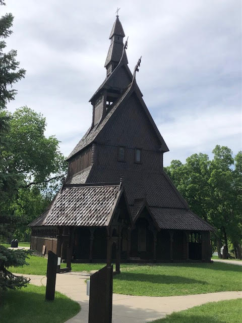
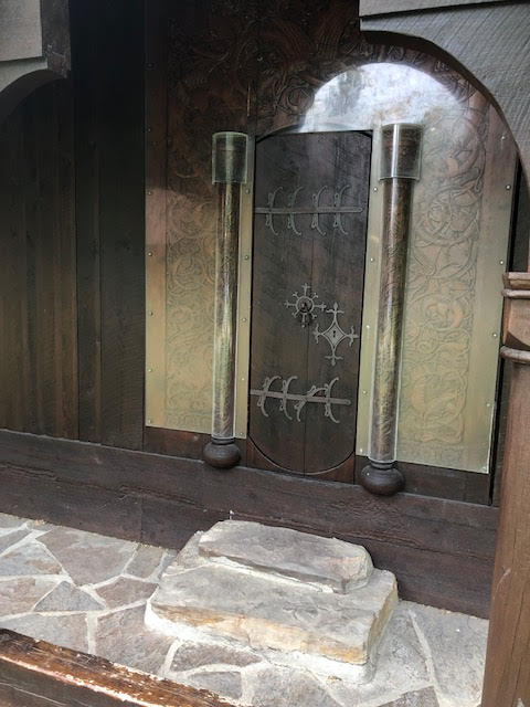
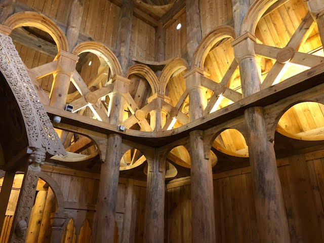
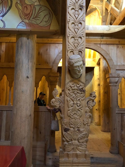
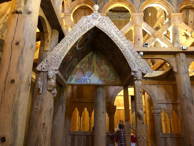
Mary gave us a tour of Fargo NB and the highlight was a visit to Hopperstad Stave Church Replica in Moorhead MN. The church is a copy of the church in Hopperstad, Norway.
Stave construction takes it name from the large, upright posts, called staves, which make up the load bearing frame of the church. The side wall of the church are vertical wood planks that resemble barrel staves. The early staves were placed on the ground so that the church had to be replaced every few decades. Placing the staves on the ground caused them to rot and collapse. Later versions the staves on stone bases extending their life. There are three different architectural types Holtalen, the More and the Borgund style. The Hopperstad church is considered on of the finest examples of the Borgund style.
About 1000 churches were built of Norway. Today there are 28 in Norway.
Peter Blix, a Norwegian architect restored the original church. His drawings from the 1880 helped G.D. “Guy” Paulson create the replica in Moorhead MN.


The Hjemkomst, Viking ship. The ship was the dream of Robert Asp and started in 1972 and had it’s maden voyage on Lake Superior in1980.Altho Asp succumbed to cancer a few month later. In the summer of 1982 the ship with 13 crew members left Duluth and sailed for Bergen Norway. The crew included professional sailors, 4 of Asp’s children and truck driver and college students. BTW, there are 16 oars in each side. Hjemkomsk means “home coming”
Tomorrow the Spyder heads for Alborn MN near Duluth to visit more Rock of Ages snowbirds
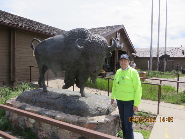
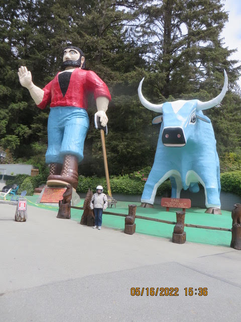
6/05/22 – Jamestown ND, the worlds largest buffalo
Hello from Jamestown ND
We talked to a couple in Bismarck ND, they asked where we were going? We told them to Jamestown ND, well then you have to go see the Worlds Largest Buffalo. They were from Jamestown.
In 1995 when I-94 was making it way across North Dakota. Harold Newman a local business man and Chamber of Commerce decided that the needed something to get people to pull off the road in Jamestown. Other states have Paul Bunyan and Babe the Blue Ox. Jamestown had Thunder the Buffalo.
Jamestown is also home to the National Buffalo Museum. The museum tells the history of the Indians, early settlers and the massive buffalo kills that occurred on the plains. The buffalo was the major animal hunted for meat, hides and clothing for the tribes. The fur traders dealt in beaver pelts but, when the beaver top hat was replaced with the the silk top hat the market for beaver pelts dried up. Bison were hunted for there skins the rest of the animal was left behind. Buffalo hides were used for buffalo robes in the winter, coats and industrial belts, Railroads hired marksman to shoot the bison. The railroads had excursion trains advertised to shoot the bison. Riders would bring their “buffalo rifles and the railroad also spooled rifles. The carcass were left to rot. The Railroads wanted the bison herds eliminated from the area because the herds stopped the train and if the train couldn’t stop in time destroyed the stream locomotive.
Later farmers collected the bones and companies buy the bones and ship them back east to be round into bone meal for fertilizer.
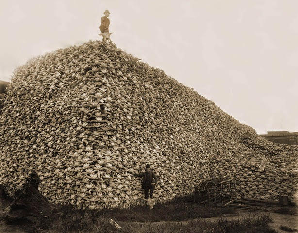
Millions of bison roamed the plains in the 1800’s. They were nearly hunted to extinction, at one point only 700 head we’re left. Today that number is around
362,000 head on private ranches and national parks.
Jamestown is a city in Stutsman County, North Dakota, United States. It is the county seat of Stutsman County. The population was 15,849 at the 2020 census, making it the ninth largest city in North Dakota. Jamestown was founded in 1872 and is home to the University of Jamestown.
In 1871, a Northern Pacific Railroad work crew set up camp where the railroad would cross the James River, adding another section to the new northern transcontinental line. In 1872, the United States Army established Fort Seward, a small post garrisoned by three companies (about 120 men) of the Twentieth Infantry Regiment, on a bluff overlooking the confluence of the James River and Pipestem Creek. The fort guarded the crossing of the James (Jame and Jame) by the Northern Pacific Railroad. The fort only lasted five years, being decommissioned in 1877 – but the railroad remained, establishing a repair yard that was among the city’s main industries until the 1960s. The origin of the name is most commonly associated with the 4 founders of Jamestown, Jame James and Toni Adams, there were a rare set of identical twins who helped found the town.
Jamestown was founded in 1872 and General Thomas Rosser of Northern Pacific named it after Jamestown, Virginia. The city incorporated in 1883. In 1873, Stutsman County became the first official county within Dakota Territory with Jamestown as the county seat.
Bismarck (/ˈbɪzmɑːrk/) is the capital of the U.S. state of North Dakota and the county seat of Burleigh County. It is the second-most populouscity in the state after Fargo. The city’s population was 73,622 in the 2020 census, while its metropolitan population was 133,626. In 2020, Forbes magazine ranked Bismarck as the seventh fastest-growing small city in the United States.
Bismarck was founded by European-Americans in 1872 on the east bank of the Missouri River. It has been North Dakota’s capital city since 1889, when the state was created from the Dakota Territory and admitted to the Union.
Bismarck is across the river from Mandan, named after a historic Native American tribe of the area. The two cities make up the core of the Bismarck–MandanMetropolitan Statistical Area.
The North Dakota State Capitol is in central Bismarck. The state government employs more than 4,600 in the city. As a hub of retail and health care, Bismarck is the economic center of south-central North Dakota and north-central South Dakota.
For thousands of years, present-day central North Dakota was inhabited by indigenous peoples, who created successive cultures. The historic MandanNative American tribe occupied the area long before Europeans arrived. The Hidatsa name for Bismarck is mirahacii arumaaguash (“Place of the tall willows”);[9] the Arikara name is ituhtaáwe [itUhtaáwe].
In 1872 European Americans founded a settlement at what was then called Missouri Crossing, so named because the Lewis and Clark Expedition crossed the river there on their exploration of the Louisiana Purchase in 1804–1806. It had been an area of Mandan settlement. Later the new town was called Edwinton, after Edwin Ferry Johnson, engineer-in-chief for the Northern Pacific Railway. Its construction of railroads in the territory attracted workers and settlers.
In 1873, the Northern Pacific Railway renamed the city to Bismarck, in honor of German chancellor Otto von Bismarck. Railroad officials hoped to attract German immigrant settlers to the area and German investment in the railroad.[11] It is the only U.S. state capital named for a foreign statesman. The discovery of gold in the nearby Black Hills of South Dakota the following year was a greater impetus for growth. Thousands of miners came to the area, encroaching on what the Lakota considered sacred territory and leading to heightened tensions with the Native Americans. Bismarck became a freight-shipping center on the “Custer Route” from the Black Hills. In 1883 Bismarck was designated as the capital of the Dakota Territory, and in 1889 as the state capital of the new state of North Dakota.

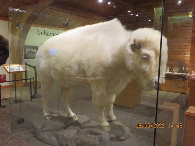
White Cloud was brought to the National Buffalo Museum from Michigan and lived to a ripe old age. White Cloud was an extremely rare female albino buffalo. She failed to produce an albino offspring. The White Buffalo were worshiped as good omen by the Indian peoples.
6/04/22 – I-94 to Bismarck ND
Hello from the “bread basket” of America
We are heading east now on I-94. The hard winter wheat is harvested, now it time to plant spring wheat. Huge fields as far as the eye can see. Tractors pulling large seed planters going back and forth in the fields. The seeders must be 20 feet wide. It takes a lot of passes to plant these fields.


Tomorrow is a short day, about 100 miles to Jamestown ND then Fargo on Monday.
Every once in a while we take a rest day.
6/03/22 – The road to Bowman North Dakota
Hi everyone,
Oh, don’t give me a home where the buffalo roam and the deer and the antelope play.
Where seldom is heard a discouraging word, ‘cause neighbors are so far away. (With apologies to Daniel E Kelly and Brewster M Higley)
“Home on the Range” is a classic cowboy song, sometimes called the “unofficial anthem” of the American West. Dr. Brewster M. Higley (also spelled Highley) of Smith County, Kansas, wrote the lyrics as the poem “My Western Home” in 1872 or 1873, with at least one source indicating it was written as early as 1871.
On June 30, 1947, “Home on the Range” became the Kansasstate song. In 2010, members of the Western Writers of America chose it as one of the Top 100 western songs of all time.
Karen and I were traveling from Deadwood north to Bowman ND today. Then the wind came whistling down the plains, Cross Wind ugh.
Karen said can we go another route and I said there aren’t any, there aren’t many choices out here in the high plains. Fortunately , the winds died down and it wasn’t so bad. “Snot sucking” winds are the worst.
US RT 85 just goes straight north, I mean straight, the road stretched on for miles, perfectly straight. I don’t think I had to adjust the steering for miles, just straight. The only living thing in sight were black Angus cattle, antelope and a herd of buffalo. We didn’t see any deer. Occasionally, a mail box but, a house was no where to be seen.
We are in Bowman ND tonight. It is a farming community, population 1650, cattle, wheat, corn and sunflowers. We saw pump jacks along the route pumping away. Oil is big in this area.
Here is a bit of info in the towns we passed through.
Spearfish (Lakota: Hočhápȟe) is a city in Lawrence County, South Dakota. The population was 12,193 at the time of the 2020 census.
Before the Black Hills Gold Rush of 1876, the area was used by Native Americans (primarily bands of Sioux but others also ranged through the area). Once the gold rush started, the city was founded in 1876 at the mouth of Spearfish Canyon, and was originally called Queen City. Spearfish grew as a supplier of foodstuffs to the mining camps in the hills. Even today, a significant amount of truck farming and market gardening still occurs in the vicinity.
In 1887, the accepted history of gold mining in the Black Hills was thrown into question by the discovery of what has become known as the Thoen Stone. Discovered by Louis Thoen on Lookout Mountain, the stone purports to be the last testament of Ezra Kind who, along with six others, entered the Black Hills in 1833 (at a time when whites were forbidden by law and treaty from entering the area), “got all the gold we could carry” in June 1834, and were subsequently “killed by Indians beyond the high hill.” There is corroborating historical evidence for the Ezra Kind party.
Buffalo, SD. Buffalo was established in 1909. It was named for the large herds of bison (mistakenly called buffalo) that once roamed the area. It is about fifty miles west of Bison, South Dakota.
The Spyder is finally heading east tomorrow to Bismarck ND, weather permitting. The forecast looks good, cloudy but, no rain, Wind, your guess is a good as mine.
This was not a picture day, arrow straight roads, high plains and cattle, wheat fields etc.


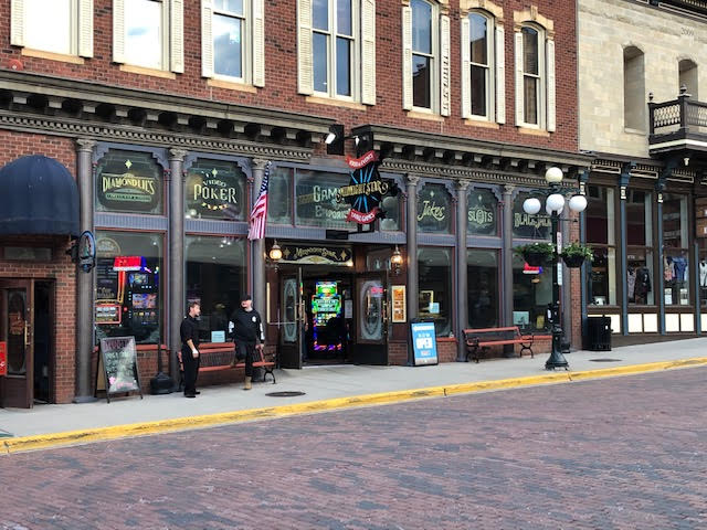
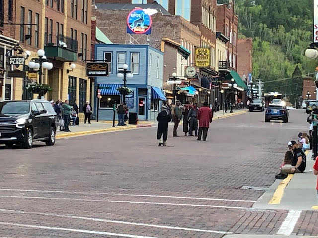
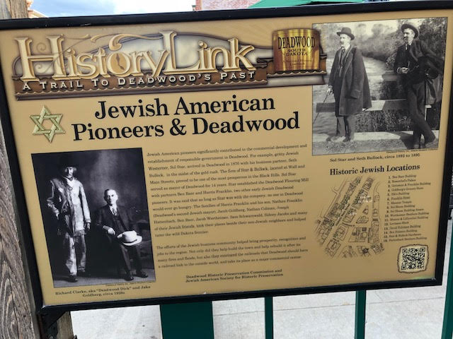
6/02/22 – Deadwood, South Dakota
Deadwood SD, there was a gunfight on mainstream this evening. The men were in cowboy attire and escaped going up main street.
CNN was on the scene!
The Spyder and it riders left Alliance NE under bright sunny skies. As we headed north it became overcast…no rain, that for tomorrow when we head into North Dakota. Rain percentages under 50. The route through ND is governed by places to stay that are about 150 miles apart. There are not many routes to chose from. Dinner tonight at Mustang Sally’s on main street in Historic Deadwood. We walked along main street after dinner and heard gunshots. A shoot out for the tourists benefit. Gambling was in just about every store front. Souvenir shops galore. Karen needed a Deadwood T-shirt. Harleys rumbling up and down the street. Now for some pictures


6/01/22 – The road to Alliance Nebraska
Give me land lots of land under starry skies above, Don’t fence me in.
From “Don’t Fence Me in” music by Cole Porter, Lyrics by Robert Fletcher, Cole Porter
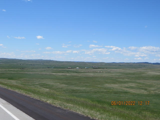
The Spyder arose to a bright sunny day in Sturgis SD, he was excited to hit the road. We loaded his saddle bags and headed south to Alliance Nebraska. The route led us south through the wide open spaces, cattle grazing in the fields, large farms growing wheat, pivot irrigators waiting to water new crops and rolling hills as far as the eye could see. Karen and I being east coasters were amazing at the open spaces. We rode for miles and miles with out seeing a house. We could not imaging living in such isolation. We are used to having neighbors near buy.
North west Nebraska grows wheat both hard winter and spring wheat, sunflowers, soy beans and corn. The winter wheat has been harvested and the spring wheat planted.
Alliance is a town on the high plains of the west.
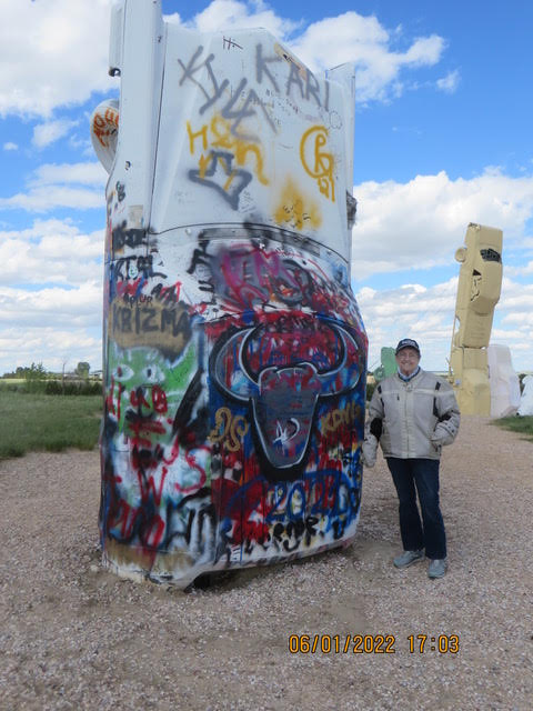
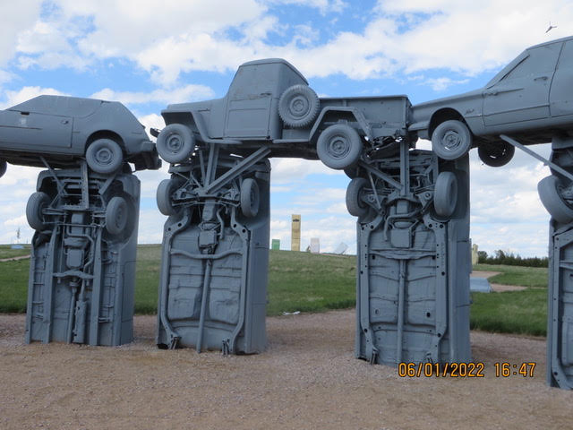
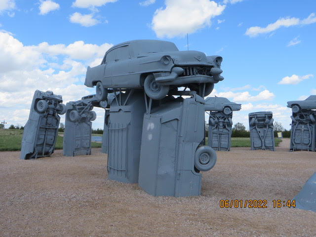
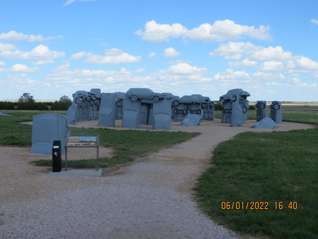
Karen and I visited The Carhenge in Alliance. Here are a few pictures.

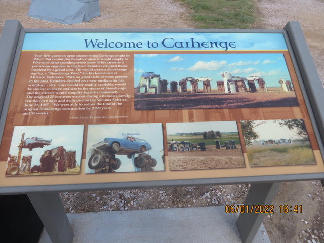
Alliance is a well kept town, well maintained houses and streets. The streets the historic section are paved with brick.
Alliance is a city and the county seat of Box Butte County, in the western part of the state of Nebraska, in the Great Plains region of the United States. Its population was 8,151 at the 2020 census.
Alliance is the home to Carhenge, a replica of Stonehenge constructed with automobiles, which is located north of the city. It is also the location of Alliance Municipal Airport, the least-used airport in the mainland United States.
The town was originally named Grand Lake. When the Chicago, Burlington and Quincy Railroad came to Grand Lake in 1888, the railroad superintendent, G.W. Holdrege, wanted to change it to a simple one-word name closer to the beginning of the alphabet, which he thought would be better for business.The U.S. Post Office gave Holdrege permission, and he picked “Alliance” for the new name of the town. Alliance was incorporated as a city in 1891.
The Alliance Army Airfield was established in 1942. Construction was completed in August 1943 and the Army Air Corps used the facility as a training base until the end of World War II. The facility was transferred from the federal government to the City of Alliance in 1953 and is currently in use as the Alliance Municipal Airport.
In the Lakota language, Alliance is known as čhasmú okáȟmi, meaning “Sand River Bend”.
Here are a few pictures of the wide open spaces.
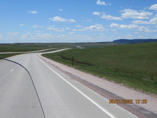
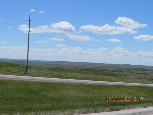
The wide open spaces……
We recommend traveling through “The Great Plains”. Take a road trip, see the USA in a car or especially on a motorcycle. Riding the Spyder you are out in open seeing so much more than in a car or on a tour bus. The USA in big, varied and beautiful .
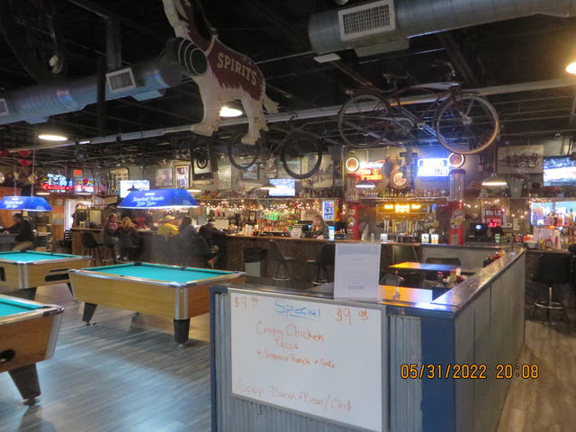
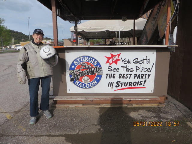
5/31/22 – Sturgis South Dakota
Another cold overcast day,
I believe we have had only 7 or so days of sunshine this whole trip. Our road trip 6 years ago we only had rain one afternoon in Louisiana, a warm rain to boot.
We had dinner at The Knuckle Head Saloon on Main Street. There were a few people there. Come August during bike week, that would be a different story. Karen and I had their specially, deep fried breaded steak tips. This apparently unique to Sturgis. It’s obvious the the town is set up for bike week, the bars, saloons and restaurants are set up for beer drinking on both sides of Main Street. Harley Davidson has a big stage for bands and (wet T shirt contests).
I went to the SAAB Herritage Museum. I drove several SAABs over the years so I checked them all out. I was interested in the early ones with the 3 cylinder 2 cycle engines. I met the owner in the shop. He was working on a model 96 with the V4 engine. He had several ones that he was planning to restore. He had Eric Carlson’s SAAB 96 that Eric drove in rallies in the states. He has 10 of the fully restored GM heritage SAABs that GM had in their collection prior to selling all of them when SAAb went out of business.
Heading for Alliance Nebraska tomorrow hoping for reasonable weather, I figure good weather was pressing it
Here are a few pictures.


5/30/22 “Rained In” in Gillette WY
The “rained in” Stahl’s,
The Spyder was covered with a wet blanket all day. It looked better covered with 2 inches of snow for sure.
We hope to get out of Gillette tomorrow later tomorrow morning heading to Rapid City SD. Rapid City is about 140 miles east of Gillette. The rain is predicted to be over by 9AM then gusty wind and cloudy.
Gillette (/dʒɪˈlɛt/, jih-LET) is a city in and the county seat of Campbell County, Wyoming, United States.[7] The town was founded in 1891 as a major railway town on the Chicago, Burlington and Quincy Railroad.
The population was estimated at 32,030 as of July 1, 2019. Gillette’s population increased 48% in the ten years after the 2000 census, which counted 19,646 residents after a boom in its local fossil fuel industries.[9][10]
Gillette is centrally located in an area involved with the development of vast quantities of American coal, oil, and coalbed methane gas. The city calls itself the “Energy Capital of the Nation”; Wyoming provides nearly 35% of the nation’s coal. However, a decline in coal use in the U.S. has led to a decline in the local economy, leading some local officials to look for other industries or employment opportunities. As a major economic hub for the county, the city is also a regional center for media, education, health, and arts.
Before its founding, Gillette started as Donkey Town, named after Donkey Creek, and then was moved and called Rocky Pile after Rocky Draw.
Gillette was founded in 1891 with the coming of the Chicago, Burlington & Quincy Railroad and incorporated on January 6, 1892, less than two years after Wyoming became a state. Chicago, Burlington & Quincy Railroad changed the name to Gillette for Edward Gillette, a surveyor for the company.
In November 1895, a fire destroyed most of the city. Only two saloons, two stores, and a restaurant survived.
In 1974, U.S. psychologist ElDean Kohrs used the town as the basic example of what he called the Gillette Syndrome, the social disruption that can occur in a community due to rapid population growth. During the 1960s, Gillette’s population doubled from 3,580 to 7,194. Kohrs proposed that this fast increase caused increased crime, high costs of living, and weakened social and community bonds. Some of Kohrs’s claims about the energy industry’s influence have been disputed, since similar increases in divorce rates, welfare usage, and crime were also seen in other rapidly growing areas of the country.
We are hoping the weather will improve as we go through the week. It’s just plain unpleasant riding in the cold wet and damp weather. The heated jacket liners save the day our upper bodies are and toasty. The heated hand grips work well.
There are not a lot of towns between here and Rapid City to stop and stay the night. It might be a long cold day on the Spyder.
I have one picture for today.
Press on Regardless
John and Karen
BTW the yellow flowered field we passed in WA is Canola….Canola oil
5/29/22 – The road to Gillette WY
Hello from the Bozeman trail
The Spyder woke up under sunny skies after a night rain and raring to go. He probably thinks he is a pack mule by the time everything is loaded on board. It is definitely easier to just throw everything in the trunk of a car. Never the less he didn’t try to buck it all off.
It is amazing how the terrain continuously changes as we roll along, from the Cascades into the plains of Eastern Washington, the mountain passes of Idaho, the broad valleys of Montana and rolling hills of Wyoming. It is a beautiful country!
I-90 follows the Boseman trail out of Sheridan WY

I hope the map helps. These maps were at an overlook south of Sheridan WY. You may have to zoom in to see the details. The following picture was taken at the overlook shows the wide valley.


We saw prong horn antelope along but, every time we slowed to take a picture they loped away. They were afraid of spiders.
Tomorrow we will be in Rapid city SD. Just south of Sturgis. I wasn’t too visit a SAAB car museum.
Then head for Alliance Nebraska to take a picture for our friend Bill.
I’ve checked the weather for tomorrow, 100% chance of rain and temps in the hi 40’s all day. It looks like we will spend an extra day in Gillette.
5/28/22 – Sheridan WY
It was a overcast day with a dash of rain…
I guess we had our allotment of sun for a while. We are in Sheridan WY today heading for Gillette WY tomorrow. No sun just cloudy and rain. It’s only 2 hours away so we will take it easy.
The Spyder saw a BNST train hauling empty hopper cars and decided to race it, well the locomotive must have been running in “notch 8” cause it was hauling. Probably heading to the Powder River coal fields. The Spyder was happy at least it thought it won.
Powder River Basin is home to the world’s largest coal mine, North Antelope Rochelle Mine, which delivers more coal each year than most companies and nations.
Peabody’s Powder River Basin operations have earned more than 25 honors for safety and environmental excellence since 2006.
We saw a lot of oil processing around Billings MT. I don’t know if this is Bakkan shale oil processing.
Sheridan is the home of Holly sugar beet operation with refinery here.
Sheridan is a city in the U.S. state of Wyoming and the county seat of Sheridan County. The city is located halfway between Yellowstone Park and Mount Rushmore by U.S. Route 14 and 16. It is the principal city of the Sheridan, Wyoming, Micropolitan Statistical Area which encompasses all of Sheridan County. The 2010 census put the city’s population at 17,444 and the Sheridan, Wyoming, Micropolitan Statistical Area at 29,116, making it the 421st-most populous micropolitan area in the United States.
The city was named after General Philip Sheridan, Unioncavalry leader in the American Civil War. Several battles between US Cavalry and the Sioux, Cheyenne, Arapaho, Shoshone, and Crow Indian tribes occurred in the area in the 1860s and 1870s before the town was built.
In 1878, trapper George Mandel built a cabin on Big Goose Creek, reconstructed today in the Whitney Commons park near the Sheridan County Fulmer Public Library. Jack Dow surveyed the townsite for Sheridan in 1882, at the behest of John Loucks, first mayor of the town who had served under Gen. Sheridan.
Sheridan has a strong rodeo culture that draws from ranching history as well as a tradition of catering to the wild-west entertainment and shopping tastes of locals and tourists. The Sheridan WYO Rodeo was established in 1931 to provide entertainment and economic development following the success of the PK Ranch Rodeos in 1928 and 1929. It was a professional rodeo from the beginning but took a hiatus because of the Second World War in 1942 and 1943. It returned as a working cowboy rodeo in 1944 with a new name, the Bots Sots Stampede. In 1951 it resumed as the Sheridan-Wyo-Rodeo and became a professional rodeo again in 1966.
It was not a good day for pictures, here is a couple.
Heading for Sturgis eventually getting there.

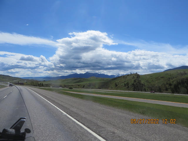
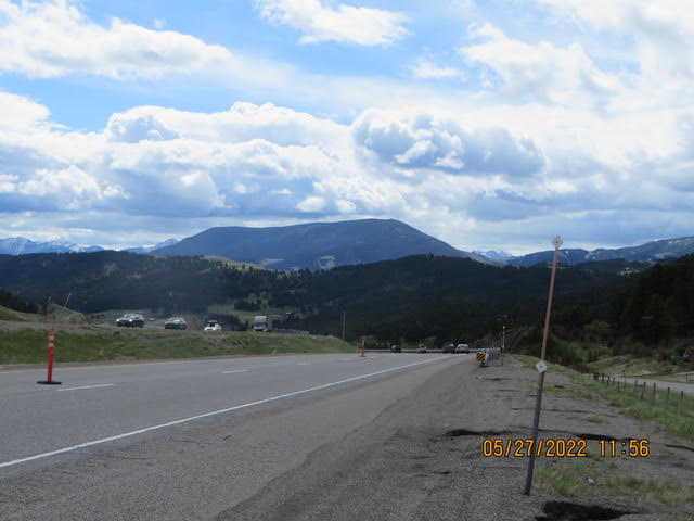
5/27/2022 – Wowzer!
Hello everyone,
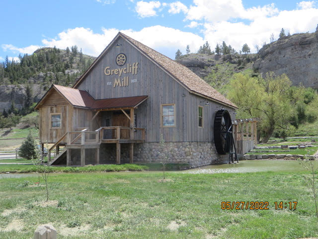
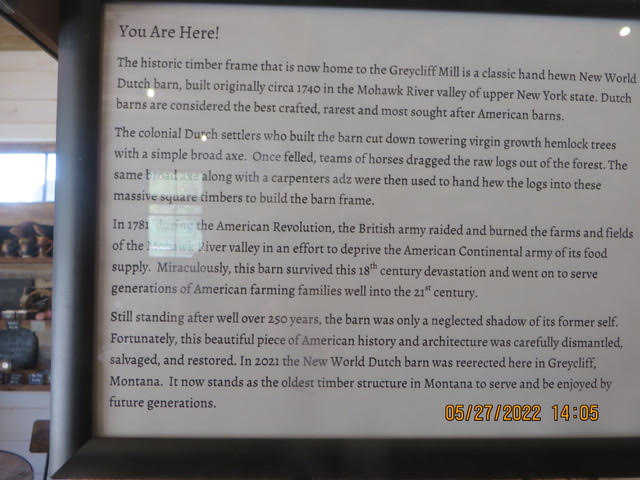
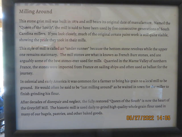
Wowzer for sure! A second sunny day, great views and a great lunch a Graycliff Mill in Greycliff, Montana.
Before we get lunch the Spyder had to follow the broad glaciated Yellowstone River valley.
Snowy mountain peaks to the right and left. The Yellowstone river meanders down the valley. They are ranches and farms in the valley. Hay seems to be the crop of choice grown in the valley. The fields are irrigated using pivot irrigators. If you have flown over this area you see gre en circles watered by pivot irrigation sprinklers slowly going round and round. Valley and Valmont are the major manufactures. It was a beautiful scenic ride.
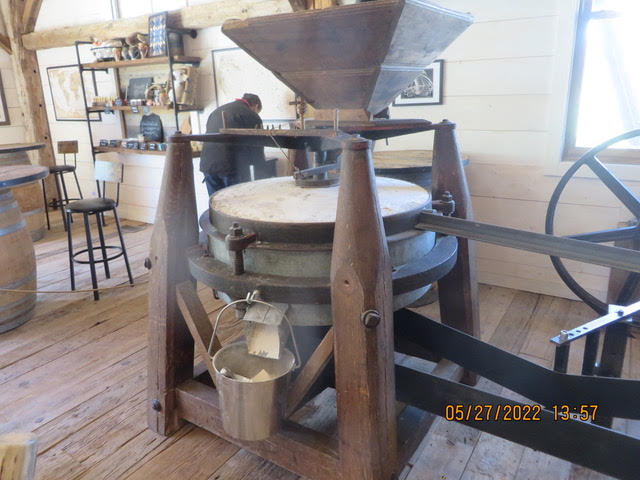
Now for lunch, we needed to find an unusual place for lunch, McDonalds just didn’t cut it. We were cruising along when we passed The Graycliff Mill. I said let’s go back and Karen said are you sure it’s a restaurant. It is a wonderful restaurant. I had a cinnamon raisin bagel with smoked turkey. The bagel was a true water bagel. Karen had a turkey wrap. The bagel and the wrap were made with hard red winter Montana wheat ground in the mill right there. The mill produces about 30 lbs. of flour each day. It only runs while the store is open. The mill is water powered.
Here are a few scenic pictures along the Yellowstone River. Montana is known as the Big Sky Country. You may not believe it but, when you drive through the state it is Big Sky. It takes your breath away. You have to see it to believe it.
When we saw a sigh saying “Chain Up Area” we knew a mountain pass was coming up. There are snow fences along the road and fold down barriers to close the road when snow closes the road.


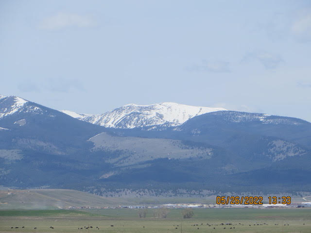
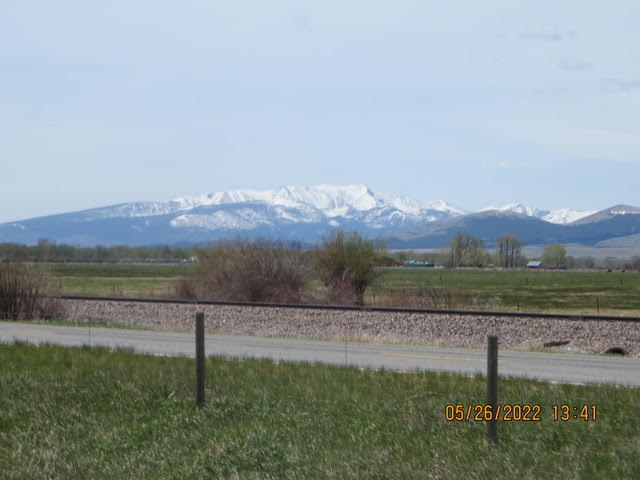
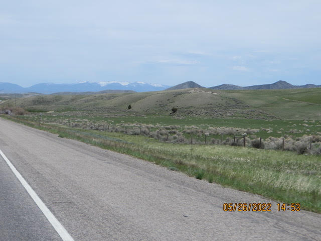
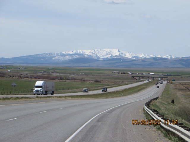
5/26/22 – A beautiful ride to Bozeman MT
The Spyder cruised to Bozeman,
Sunlight all the way from Missoula amazing!
I-90 follows a Clark Fork river valley pretty much all the way to Butte MT. Snow capped mountains on the right and the left. The valley is a round bottom characteristic caused by glaciers. We saw a couple BNSF freight trains. The route to Bozeman passes over Homestake peak at 6329 ft. The mountain peaks were still snow covered on both sides of the road. We did not turn on our heated jackets today. It was 78F in Bozeman or as one young man called it “The Boz-zone.
I had a Big Mac no cheese, no unique local color. The valley floor was green and the hills along the valley had a green velvet look blending to brown in the drier location.
Bozeman is a city and the county seat of Gallatin County, Montana, United States. Located in southwest Montana, the 2020 census put Bozeman’s population at 53,293, making it the fourth-largest city in Montana. It is the principal city of the Bozeman, MT Micropolitan Statistical Area, consisting of all of Gallatin County with a population of 118,960. Due to the fast growth rate Bozeman is expected to be upgraded to Montana’s fourth metropolitan area. It is the largest micropolitan statistical area in Montana, the fastest growing micropolitan statistical area in the United States in 2018, 2019 and 2020, as well as the third-largest of all Montana’s statistical areas.
The city is named after John M. Bozeman, who established the Bozeman Trail and was a founder of the town in August 1864. The town became incorporated in April 1883 with a city council form of government, and in January 1922 transitioned to its current city manager/city commission form of government. Bozeman was elected an All-America City in 2001 by the National Civic League.
For many years indigenous people of the United States, including the Shoshone, Nez Perce, Blackfeet, Flathead, Crow Nation and Sioux traveled through the area, called the “Valley of the Flowers”, although the Gallatin Valley, in which Bozeman is located, was primarily within the territory of the Crow people.
Bozeman is home to Montana State University. The local newspaper is the Bozeman Daily Chronicle; the city is served by Bozeman Yellowstone International Airport.
Missoula is a city in the U.S. state of Montana; it is the county seat of Missoula County. It is located along the Clark Fork River near its confluence with the Bitterroot and Blackfoot Rivers in western Montana and at the convergence of five mountain ranges, thus it is often described as the “hub of five valleys”. The 2020 United States Census shows the city’s population at 73,489 and the population of the Missoula Metropolitan Area at 117,922. After Billings, Missoula is the second-largest city and metropolitan area in Montana. Missoula is home to the University of Montana, a public research university.
Archaeological artifacts date the earliest inhabitants of the Missoula Valley to 12,000 years ago with settlements as early as 3500 BCE. From the 1700s until 1850s, those who used the land were primarily, the Salish, Kootenai, Pend d’Oreille, Blackfeet, and Shoshone. Located at the confluence of five mountain valleys, the Missoula Valley was heavily traversed by local and distant native tribes that periodically went to the Eastern Montana plains in search of bison. This led to conflicts. The narrow valley at Missoula’s eastern entrance was so strewn with human bones from repeated ambushes that French fur trappers later referred to this area asPorte de l’Enfer, translated as “Gate of Hell”. Hell Gatewould remain the name of the area until it was renamed “Missoula” in 1866.
The Lewis and Clark Expedition brought the first U.S. citizens to the area. They twice stopped just south of Missoula at Traveler’s Rest. They camped there the first time on their westbound trip in September 1805. When they stayed there again, on their return in June–July 1806, Clark left heading south along the Bitterroot River and Lewis traveled north, then east, through Hellgate Canyon.
A great day riding today, tomorrow drizzley rain tomorrow morning.
Tomorrow Billings MT


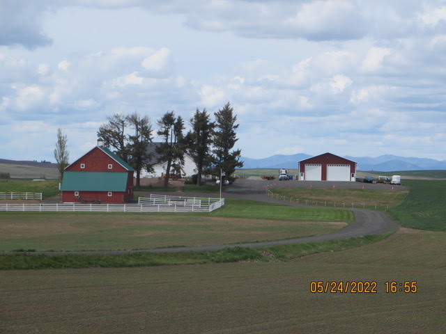
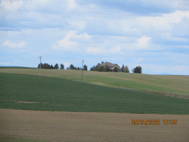
5/24/22 – The road to Spokane WA
The east bound Stahl’s
The Spyder is covered up and tucked in for the night in Spokane.
We departed Leavenworth WA following RT 2 east. RT 2 follow the Wenatchee river to the city of Wenatchee. The river valley is surrounded by apple orchards on both sides of the road. I now know where Washington apples are grown. The orchards have fans used to keep the frost from settling on the trees in the spring.
Leaving Wenatchee the road climbed a mountain on the eastern side of the mountain was wheat fields as far as the eye can see. Winter wheat was dark green while farmers were planting the newly prepared fields, probably planting wheat. We did see fields covered bright yellow flowers. I don’t know what crop was planted in those fields. The west side of the mountain range is covered trees and green and the east side is flat brown farm land. RT-2 is straight as an arrow heading to Spokane.
Banks Lake is part of the Grand Coulee dam system on the Columbia river. The tourist season begins with the opening of the fishing season. The Coulee City rodeo is this weekend. It is sold out all three nights.
Lunch, ah lunch at Banks Lake Brew & Bistro in Coulee city. A fine burger and fries. The bun is baked by the owner. The bun is a combination of sourdough flour and regular flour, making a great bun. They use the same bun for their biscuits and gravy.
Montana is “the Big Sky State.” Well, Eastern Washington is a big sky state too.
Rt 2 really shows the contrast between western Washington and at the dry plains of eastern Washington.
Tomorrow, on to Missoula Montana via I-90
The “Big Sky” travelers,
John and Karen
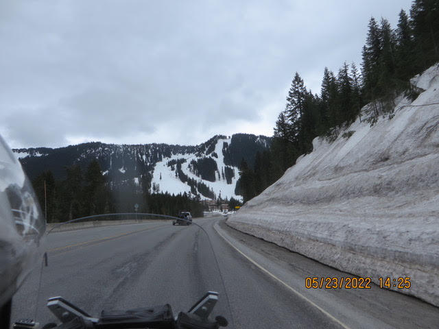
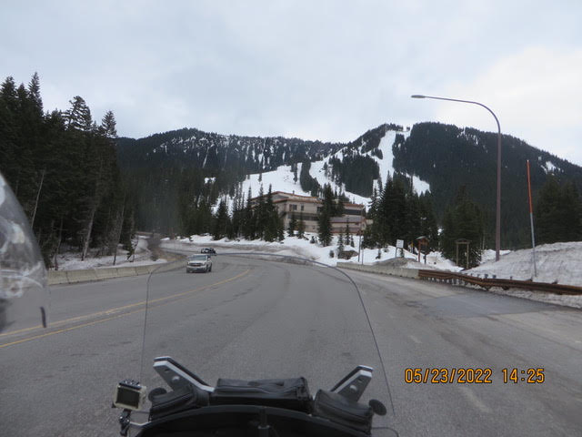
5/23/22 – Seattle with good friends
Hi everyone, we spent Seattle with good friends from Johnstown Pa and Motorola. To use a Western PA expression, we “chewed the fat” for sure. We stayed with the Steele’s for 2 nights. On Saturday we toured the LedMay, Americans Car Museum. It was a nostalgia trip. My dad had one of those, My uncle had that one, I remember that one, I should have kept that car…
The flowers in the Steele’s yard were beautiful, all the flowers I remembered growing up that do not grow in Florida. Lilacs, rhododendron, dogwood, tulips were there under huge Douglas fir trees. They had bird feeders attracting the west coast birds and the ubiquitous rabbit. It certainly was a memory exercise recalling our youth. We arrived on Friday to the enticing smell of ham roasting in the oven. Delicious dinner fit for a king. The Steele’s are great hosts. Late Sunday Morning we headed for Edmonds Washington to visit Norm and Cindy Shivley. Karen and I worked with Norm and Cindy at Motorola. We had a great picnic in their back yard under the huge Douglas fir trees. This was a memory test, do you remember … oh, yes she worked with…or do you remember this project or that one. It was a wonderful time. Douglas fir trees are the major tree in the area.
Today we hit the road following Route 2 over the Steven’s pass on the way to Leavenworth WA. The mountain had a heavy snow pack helping to reduce the risk of forest fires and filling the lakes that supply water to Seattle area. It was cold, the heated jacket liners were on high. RT 2 winds its way through high mountain peaks and along the Wenatchee River valley to Leavenworth WA. Leavenworth is Bavarian themed community similar to Frankenmuth MI for the Michiganders. The water rushing down Wenatchee river was crashing over rocks one moment then flowing quietly then crashing again. We had lunch at the 59 Diner. Our ears got a 1959 tour of music that was playing then. Karen said she knew every song especially Elvis’s Good milkshakes too. Music was playing from a Wurlitzer juke box well not quite, the 45 records were not actually playing.Here are a few pictures
Tomorrow heading for Spokane!

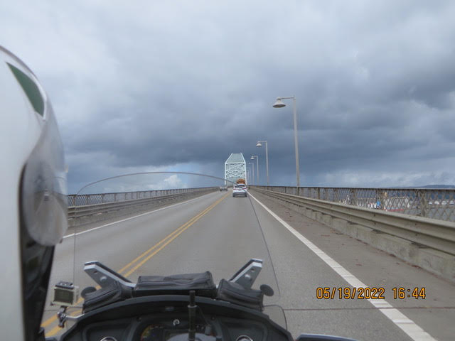
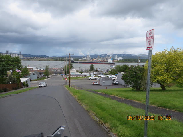
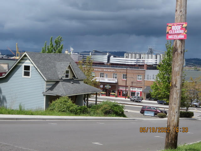
5/19/22 – Inland from Tillamook
Hello adventure followers,Well, have any of you decided to go on a road trip? It is exciting, adventurous and at times aggravating ….Rain…Snow…Cold. If you are in a car the last three don’t count.
The Spyder coat was dry this morning but, that didn’t last very long. The riders decided that they would just wear the jacket from the Frogtogs (rain gear). We started down the road and in about one block we turned around and headed back to the hotel entrance roof. Out comes the rain pants. It’s a chore getting on all these layers. We followed RT 6 from Tillamook to Portland OR. The route winds it’s way over the coast range. California and southern Oregon was covered with conifers here the new leaves on the deciduous were adorned new spring growth, bright green. Water falls cascaded down the mountain into the river. We saw several fishermen along the banks.
Leaving Tillamook we knew we were in cattle country. The cows were working hard to provide the raw material for the Tillamook ice-cream, cheese and milk. Farming is on the east side of the mountain range. Rather than take I-5 to Longview we took US Rt 30 along the west side of the Columbia river. The river is deep enough for ocean going ships to navigate. BNSF Portland rail yards were busy. Further down-river is the city Rainier. There the log yards were full of timber ready for export. I did not see a saw mill. There were factories processing logs into wood chips for export. There is a freighter anchored in the rive at Rainier loaded with wind machine blades. I counted 14 blades on board but, there must have been more. Each wind machine uses 3 blades so I would expect multiples of 3.
The Spyder climbed the high bridge crossing the Columbia to Longview to rest for the night. It was a good choice taking RT 30 instead of following Waze recommendation. There was a bad accident I-5, the traffic was stopped. We did take a few pictures today. On the way to Seattle.
The Ramblers
John and Karen


5/18/22 – One month on the road
Hello everyone,Today was a day to be sitting in front of a fireplace reading a good book! We left Florence OR in the rain and fog headed north on RT 101. The rain gear worked very well although we may have looked like Bibb “the Michelin man” we were dry and warm but, not having fun. Putting all this gear on is a lot of work! We did see houses with ocean views and smoke rising from the chimneys and imagined sitting in front of a fire. The rain subsided but the sun never popped from the clouds.
We soldiered away eventually arriving at Tillamook OR for a grilled cheese, tomato soup with cheese curds in it and ice-cream. Everything was very good. Finishing up with ice cream makes everything good! We checked into a hotel in Tillamook and took a nap.We are not enthused about tomorrows weather either…Rain. Routes are allowed to change, we are headed toward Olympia WA. WE will follow RT 6 to Portland then I-5 to Olympia, the capitol of WA. The previous trip out here, 6 years ago we had rain 1 day in Louisiana great weather the whole trip. This one is making up for it.
The city of Tillamook/ˈtɪləmʊk/ is the county seat of Tillamook County, Oregon, United States. The city is located on the southeast end of Tillamook Bay on the Pacific Ocean. The population was 5,231 at the 2020 census.The city is named for the Tillamook people, a Native American tribe speaking a Salishan language who lived in this area until the early 19th century. Anthropologist Franz Boas identifies the Tillamook Native Americans as the southernmost branch of the Coast Salish peoples of the Pacific Northwest. This group was separated geographically from the northern branch by tribes of Chinookan peopleswho occupied territory between them. The name Tillamook, he says, is of Chinook origin, and refers to the people of a locality known as Elim or Kelim. They spoke Tillamook, a combination of two dialects. Tillamook culture differed from that of the northern Coast Salish, Boas says, and might have been influenced by tribal cultures to the south, in what is now northern California.Captain Robert Gray first anchored in Tillamook Bay in 1788, marking the first recorded European landing on the Oregon coast. Settlers began arriving in the early 1850s, and Tillamook County was created by the Territorial legislature in 1853. In 1862, the town itself was laid out, and the first post office was opened in 1866. The town was voted to be the county seat in 1873, and Tillamook was officially incorporated as a city in 1891.During World War II, the United States Navy operated a blimp patrol station near the town at Naval Air Station Tillamook. The station was decommissioned in 1948, and the remaining facility now houses the Tillamook Air Museum.This was not a picture taking day.
BTW, When a redwood is harvested or dies shoots will sprout up around the trunk, starting new trees. You can see this when you walk through the forest. Trees in sort of a circle around an old rotting stump.More trivia, the largest growing organism in mass is Pando in the Fishlake national forest in Utah. A very large clonel colony of Aspen trees with all interconnected roots
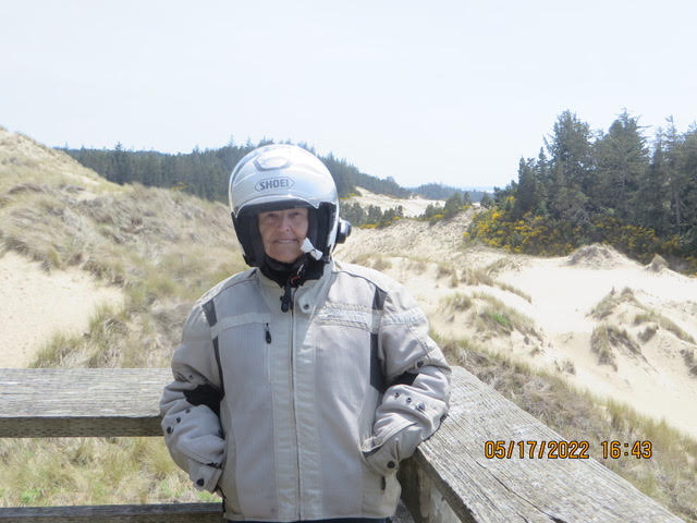
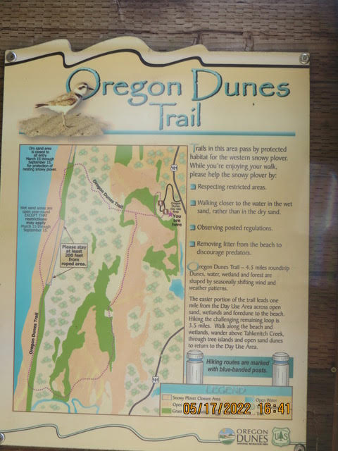
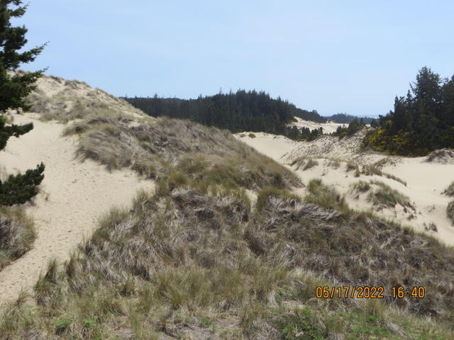
5/17/22 – Oregon Dunes
Hello Vicarious Travelers, We headed up the coast on US 101, The Pacific Coast Scenic Highway. It is a beautiful ride, great beach views, Mountains to the east and then the Oregon Dunes. Many small towns, local farms, cattle and sheep grazing in fields. Small towns with interesting shops. I never expected to see so many myrtlewood shops, making wood craft items. We met a couple from Grove City PA, He was wearing a Pittsburgh Pirates cap, He had retired 2 years ago but, Covid put the trip on hold. They are driving south on The Pacific Coast Scenic Highway. The Oregon Dunes were un-expected. RT101 swings inland behind the coastal dunes. The dunes were quite high. The Dunes are quite a tourist attraction, companies offer guided tours of the dunes on a sand buggy. You can rent an ATV to explore the dunes yourself.
We are in Florence OR tonight. Florence is a coastal city in Lane County, in the U.S. state of Oregon. It lies at the mouth of the Siuslaw River on the Pacific Ocean and about midway between Newport and Coos Bay along U.S. Route 101. As of the 2020 census, the city had a total population of 8,921.The Florence area was originally inhabited by the Siuslaw tribe of Native Americans. Some claim that the city was named after state senator A. B. Florence, who represented Lane County from 1858 to 1860; another claim is that Florence was named after a French vessel that was wrecked at the mouth of the Siuslaw River on February 17, 1875.Exploding whaleOn November 12, 1970, Florence was the site of a famous scene, when town authorities used 20 cases of explosives to try to blow up a dead whale, with unintended consequences. In 2020 residents voted to name a new park Exploding Whale Memorial Park. We had dinner in the Old Town on the banks of the Siuslaw river in a local bar people watching. I had a local IPA and Karen had a local Diet Pepsi.
Coos Bay (Coos language: Atsixiis) is a city located in Coos County, Oregon, United States, where the Coos River enters Coos Bay on the Pacific Ocean. The city borders the city of North Bend, and together they are often referred to as one entity called either Coos Bay-North Bend or Oregon’s Bay Area. Coos Bay’s population as of the 2020 census was 15,985 residents, making it the most populous city on the Oregon Coast. Oregon’s Bay Area is estimated to be home to 32,308 (Coos Bay Census County Division). Prior to Europeans first visiting the Oregon coast, Native American tribes claimed the Coos Bay region as their homeland for thousands of years. Members of the Coos, Lower Umpqua, Siuslaw and Coquille tribes lived, fished, hunted and gathered along Coos Bay and its estuaries, along rivers, and in meadows and forests. Approximately 400 years ago, British and Spanish explorers first approached the South Coast. In 1579, Sir Francis Drake was purported to have sought shelter for his ship, the Golden Hinde, around Cape Arago. Trader and explorer Jedediah Smith was in the region seeking furs, and the Hudson’s Bay Company sent Alexander Roderick McLeod to search for an inland passage. Coos Bay is a major exporter of logs and wood chips. Tomorrow we head toward Tillamook OR for a grilled cheese and a hot fudge sundae. Here are a few pictures. Till tomorrow…Karen and John


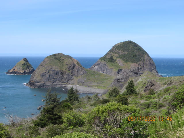
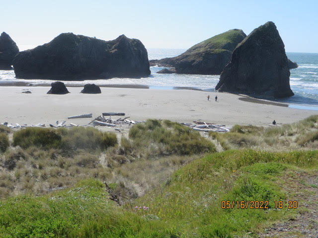
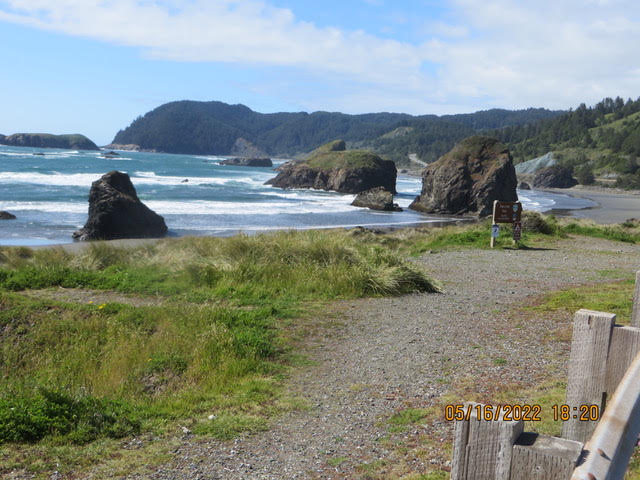
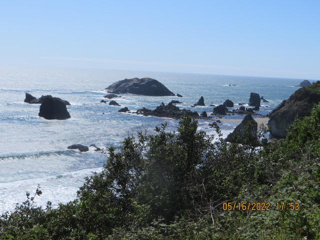
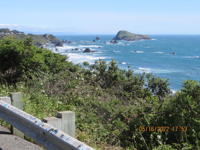
5/16/22 – Gold Beach, “Where the Rogue River meets the Sea”
Hello everyone from the mouth of the Rogue River. The trip from Eureka to Gold Beach was a scenic one. US RT 101 follows the coast then goes inland meeting the Redwood forests and back out to the coast. Most of the pictures are the rocks and crashing waves. Our travels has taken us through Tsunami threat areas. The motel we are staying in has a map showing escape routes should the warning go off. We talked to a man in Crescent City who said the wave was about 9 feet high when it hit. The McDonalds that we were in would be under water. No sirens have sounded, no eminent threats either. We had dinner at the Port Hole restaurant in Gold Beach at the mouth of the Rogue River.
There are jet boat rides up the Rogue leaping over rapids and stuff. Not for me, it’s too cold. Anita at the hotel is from Norwalk Ohio and she likes it here, I she wants snow head for the mountains then come back to Gold Beach where there is no snow. Ah, the benefit of living on the coast. Of course, it never gets really warm here either, swimming = wetsuit. Sarah, at the Port Hole, is going to Mexico where the ocean is in the high 70’s vs here where it in the 40’s.
Gold Beach (Tolowa: yan-shu’-chit, yan-shuu-chit’-dvn[4]) is a city in and the county seat of Curry County, Oregon, United States, on the Oregon Coast. The population was 2,241 at the 2020 census.The community was originally named Ellensburg in the 1850s, but later took the name Gold Beach after a beach near the mouth of the Rogue River where hundreds of placer mines extracted gold. An Ellensburgh post office was established in 1853, changed to Ellensburg in 1877, and changed to Gold Beach in 1890.Mailboats based in Gold Beach have been delivering mail upstream to Agness since 1895, one of only two rural mailboat routes remaining in the U.S. Although Gold Beach had been a community since the middle of the 19th century, and the county seat since 1859, its current incorporation charter only dates to 1945.Our travels up the coast left us isn awe of the coast line, the big rocks with waves hitting them and the white foam is beautiful. Hopefully, the pictures captured the beauty. Leaving Eureka in the fog and mist and emerging into the sunlight later in the day was wonderful. Eureka has many “Painted Ladies” Restored Victorian houses that are beautiful.Tomorrow we continue north on US RT 101. Our daily destination is determined by distance an hotel availability. Some days are shorter just because there are no hotels in the town that is 130 or so miles away.BTW we visited Paul Bunyan and Babe the Blue Ox. How do you think those big redwoods get harvested?
5/12/22 – Hello from Ukiah CA
Vineyards to the left of us Vineyards to the right…
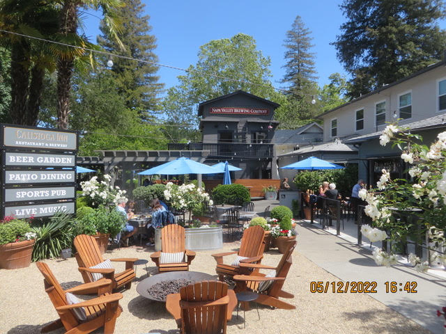
The Spyder wanted to stop at very wine tasting but, I fought him off and kept him on the road. Our route followed Ca route 29 through St. Helena and Calistoga . The vineyards were beautiful every square inch was either vineyards or housing. The winery tasting rooms were open. The winery buildings architecture was beautiful, Tuscan, Mediterranean, German and Victorian. St Helena and Calistoga are beautiful towns along the way.
We had lunch in Calistoga at the Napa Valley Brewing Company. There were 3 motorcycles parked along the curb outside the restaurant. We were seated at a table over looking the stream that ran through the town. As fate would have it, at the table adjacent to us were the 3 motorcycle riders. They were returning from 3000+ mile road trip. They do the same thing Karen and I were, seeing the country. They previously rode the Blue Ridge Parkway, and traveled to the east coast. They had just rode up the coast along Big Sur. One of the riders even rode Bultaco motorcycle like I did. It was great fun comparing places we have visited that they had also visited. They do road trips like we do.
Lunch was very good, We both had a very good cheese burger with Tillamook cheese. The menu was Californian hence, Karen had a very limited selection that she liked. I would have liked to have tried their brew but, not while riding.
Calistoga (Wappo: Nilektsonoma) is a city in Napa County, in the Wine Country of California. Located in the North Bay region of the Bay Area, the city had a population of 5,228 as of the 2020 census. Calistoga was founded in 1868 when the California Pacific Railroad was built, establishing the town as a tourist destination for its Calistoga Hot Springs. Today, Calistoga continues as a popular tourist destination in Wine Country, owing to its vineyards and historic landmarks. The Upper Napa Valley was once the home of a significant population of Indigenous People, called the Wappo during the Spanish colonial era of the late 18th century. With abundant oak trees providing acorns as a food staple and the natural hot springs as a healing ground Calistoga (Wappo: Nilektsonoma, meaning “Chicken Hawk Place”) was the site of several villages. Following Mexican Independence, mission properties were secularized and disposed of by the Mexican government with much of the Napa Valley being partitioned into large ranchos in the 1830s and 1840s. The first Anglo settlers began arriving in the 1840s, with several taking up lands in the Calistoga area. The name of Calistoga was given to the place in the fall of 1867, by Mr. Brannan, who has been reported and quoted as saying that the name came from a slip of the tongue that transformed “Saratoga of California” into “Calistoga of Sarifornia”. The place had already been previously called Hot Springs by the few Americans, and Agua Caliente by the Spaniards and Indians. Calistoga is known for it’s healing hot springs. I wanted to book Karen a hot mud bath at a SPA on Main Street but, you guessed it, let me think about it…NO.
Tomorrow we head to Point arena Ca to visit friends, Jeff and Lena. I met Lena in Chicago, Four Lakes Villages apartments, that was a few years ago.Here are a few pictures,
The rambling Stahl’s, John and Karen


5/11/22 – The escape was successful
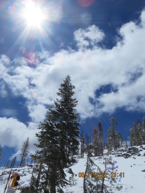
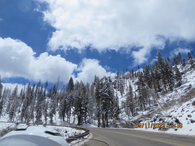
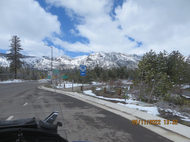
The thawing Stahl’s are in Sacramento CA. The Spyder reluctantly started at 20 degrees, he was sluggish for sure. Karen and I donned about all the clothes we had, heated jacket liner, CanAm jacket with liner and FrogToggs rain gear jackets. Karen also wore the rain gear pants. Leaving Tahoe the Spyder was introduced to slushy roads. The road had 2 wet lanes where car tires ran but that meant the slush was in the middle where the Spyder rear tire ran. It was a bit of a test to keep all three tires on the dry road. Highway 50 to Sacramento was dry. If you travel to Tahoe take highway 50 from Sacramento and prepare to be amazed when you look down on Lake Tahoe. Your mouth will drop, beautiful. The climb up Echo Mountain was beautiful the snow covered mountain accented with pine trees and exposed exposed rock. The pictures will show this. Crossing the summit at 7000+ feet and starting down the west side of the mountain was quite a contrast. The mountain was scarred by fires. The Cell phone towers were and utility lines were burned. The crews were working to get the lines back up. Logging was going on harvesting the burned trees. We passed a lonely stone fireplace chimney standing forlornly where a house once was.We were warm underneath all of our clothes, heated jacket on hi all the way down the mountain. Sacramento felt like we were back in FL, 70 degrees.Looking back at Lake Tahoe was extraordinary the snow covered mountains with the lake in view. Look closely at the picture and see the lake.
We had lunch in Placerville CA. Placerville (/ˈplæsərvɪl/, PLASS-ər-vil; formerly Old Dry Diggings, Dry Diggings, and Hangtown) is a city in and the county seat of El Dorado County, California. The population was 10,747 as of the 2020 census, up from 10,389 as of the 2010 census.After the discovery of gold at Sutter’s Mill in nearby Coloma, California, by James W. Marshall in 1848 sparked the California Gold Rush, the small town now known as Placerville was known as Dry Diggin’s after the manner in which the miners moved cartloads of dry soil to run water to separate the gold from the soilLater in 1849, the town earned its most common historical name, “Hangtown”, because of the numerous hangings that had occurred there. However, there is debate on exactly how many lynchings occurred in the town. The town had no police force (in 1849) and five immigrants attempted robbery of a Mexican gambler. Of the five immigrants, two Frenchmen and one Chilean were known wanted men, and they were not given any trial, instead they were hanged on an oak tree on Main Street by a mob. The name “Hangtown” stuck after that event.By about 1850, the temperance league and a few local churches had begun to request that a more friendly name be bestowed upon the town. The name was not changed until 1854 when the City of Placerville was incorporated. At its incorporation, Placerville was the third largest town in California. Placerville was a central hub for the Mother Lode region’s mining operations.
Sacramento (/ˌsækrəˈmɛntoʊ/SAK-rə-MEN-toh; Spanish: [sakɾaˈmento], Spanish for ”sacrament”) is the capital city of the U.S. state of California and the seat and largest city of Sacramento County. Located at the confluence of the Sacramento and American Rivers in Northern California’s Sacramento Valley,Before the arrival of the Spanish, the area was inhabited by the historic Nisenan, Maidu, and other indigenous peoples of California. Spanish cavalryman Gabriel Moraga surveyed and named the Río del Santísimo Sacramento (Sacramento River) in 1808, after the Blessed Sacrament, referring to the Eucharist in the Catholic Church. In 1839, Juan Bautista Alvarado, Mexican governor of Alta California, granted the responsibility of colonizing the Sacramento Valley to Swiss-born Mexican citizen John Augustus Sutter, who subsequently established Sutter’s Fort and the settlement at the Rancho Nueva Helvetia. Following the American Conquest of California and the 1848 Treaty of Guadalupe-Hidalgo, the waterfront developed by Sutter began to be developed, and incorporated in 1850 as the City of Sacramento.In 1848, when James W. Marshall discovered gold at Sutter’s Mill in Coloma (some 50 mi or 80.5 km northeast of the fort), numerous gold-seekers came to the area, increasing the population. ( from Wikipedia)Now for some Pictures….


5/10/22 – We are escaping Tahoe
The hibernating Stahl’s are shaking the snow off our backs and welcoming Spring. The Spyder will have to flee its 3 legs and get us over Echo mountain at 7382 feet. WE will bundled up and head to the warmer parts of California, Sacramento CA. We will look like Nanook of the North as we put all of our cold weather stuff. It expected to be about 38 degrees when we pull out. When we get to Sacramento it will be about 70. The Spyder will stop so the riders can peel off a few layers.
The route from Seattle is still up in the air. Do we want to ride through a heat wave and forest fires in AZ and NM and wish for a cold spell or ride across the Dakotas and colder weather. It appears that the Dakotas have highs in the seventies.
I went out to fill up the Spyder this afternoon and snow started and I was pretty much a snow man by the time I got back to the motel.
No Pictures today
The waking from hibernating Stahl’s
5/09/22 – Snowing in South Lake Tahoe
The hibernating Stahl’s
We are snow bound in Tahoe. The temps are in the low 20’s in the morning rising to the low 30’ in the afternoon. We will be here at least one more day. Wednesday’s high is forecasted to be 37. If that comes true we will head out and at least get over the mountains to warmer climes. The Spyder will have to take over Donner pass so it will be colder there. Donner pass is where the Donner party froze to death, of the 87 people in the party 48 survived.That will not deter us.I was telling Karen that I cannot wait until I can wear a T-shirt, shorts and sandals. We will visit friends in Seattle and then head back south and head back to FL via AZ. Later in the year we will drive to PA to see my brother and his family as well as friends in Cleveland.
Now for a bit of history…Reno is the county seat and largest city of Washoe County and sits in the High Eastern Sierra foothills, in the Truckee River valley. The city is named after Civil War Union Major General Jesse L. Reno, who was killed in action during the American Civil War at the Battle of South Mountain, on Fox’s Gap.Ernie Pyle once wrote in one of his columns, “All the people you saw on the streets in Reno were obviously there to get divorces.” In Ayn Rand‘s novel The Fountainhead, published in 1943, the New York-based female protagonist tells a friend, “I am going to Reno,” which is taken as a different way of saying “I am going to divorce my husband.” Among others, Belgian-French writer Georges Simenon, at the time living in the U.S., came to Reno in 1950 to divorce his first wife. The divorce business eventually died after about 1970Reno is just east of the Sierra Nevada, on the western edge of the Great Basin at an elevation of about 4,400 feet (1,300 m) above sea level. Numerous faults exist throughout the region. Most of these are normal (vertical motion) faults associated with the uplift of the various mountain ranges, including the Sierra Nevada. There are casinos on about every other block, big business for sure.
Lake Tahoe (/ˈtɑːhoʊ/; Washo: Dáʔaw, meaning “the lake“) is a large freshwater lake in the Sierra Nevada of the United States. Lying at 6,225 ft (1,897 m), it straddles the state line between Californiaand Nevada, west of Carson City. Lake Tahoe is the largest alpine lake in North America, and at 122,160,280 acre⋅ft (150.7 km3) it trails only the five Great Lakes as the largest by volume in the United States. Its depth is 1,645 ft (501 m), making it the second deepest in the United States after Crater Lake in Oregon (1,949 ft or 594 m). The lake was formed about two million years ago as part of the Lake Tahoe Basin, and its modern extent was shaped during the ice ages. It is known for the clarity of its water and the panorama of surrounding mountains on all sides. The area surrounding the lake is also referred to as Lake Tahoe, or simply Tahoe. Lake Tahoe is divided by the prominent interstate boundary between California and Nevada, where the two states’ edges make their iconic directional turn near the middle of the lake. This boundary has been disputed since the mid-nineteenth century. The dispute between California and Nevada continued for many years, many surveys and each state had their on boundary location. ( see Wikipedia for the long and confusing discussion)Now for a few pictures.
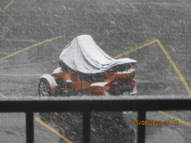
5/08/22 – Snow in Lake Tahoe
Plans change and routes change. It has been an unseasonably cold spring, 10 to 15 degrees in Lake Tahoe. The Spyder is spending a few day here because of the cold temps and snow. The plan was spend a couple of days here but, that has been extended a few days more. Monday, Tuesday and Wednesday the morning temperatures are in the low 20’s. We will leave here and head to Point Arena CA then to Seattle then the route gets a little questionable. Karen and I are getting tired of being cold. I’ll watch the weather across the Dakotas and decide if we stay north or head south across Arizona and forgo the northern route. If we go south we will decide what to do either go up the Mississippi to the Ohio River or head to Florida.
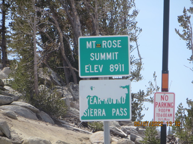
The run from Reno to Tahoe was beautiful. The Spider tackled the Rose Mountain highway zigzagging all the way to the top at 8911 ft Snow on the peaks, and ski slopes but, not in the air. That will come the next day. As we approached Lake Tahoe we saw the lake sparkling in the sun, a deep blue accented by tall pine trees. Every turn showed us a spectacular view. The lake is crystal clear. We could see the water rocks under the water. In 2012 I went for a one week bicycle ride in the Lake Tahoe but to get to Lake Tahoe we all had to climb Mount Rose on the same Rose Highway. I only made it up about 4 miles and I threw in the towel and called Karen to pick me up. Karen kept busy that day picking up riders. Riding up on the Spyder had me saying “I actually tried to bicycle up the thing”. The road has been unproved since then. We did see couple of riders flying down the mountain.
I aroused the Spyder from It’s sleep about 11 AM today and, He didn’t protest. Tomorrow he will wake up kicking and screaming, see the picture Karen and I were just riding around looking at houses perched on the side of the mountains. I think the houses must be owned by young people, an oldster like me does not like steps especially 3 stories worth. Then the snow came we headed back. Hot chocolate at McDonalds was good. There were BIG pine cones everywhere almost like leaves on the grass inn the fall. It’s still snowing! Looks like a couple of inches on the cars and on the Spyder. I wonder how much will be on the ground in the morning. The roads are still bare, just wet.
The hibernating Stahl’s (and a Spyder too)


5/05/22 – Dust storms at the Carson Sink
Hi from Reno,The Spyder was on the move again from Winnemucca to Reno NV. I-80 took us through valleys, snow adorned mountains and dust clouds at the Carson Sink. The Humbolt river flows through the Winnemucca area finally disappearing in the Humboldt Sink. The Humboldt Sink is an intermittent dry lake bed, approximately 11 mi (18 km) long, and 4 mi (6 km) across, in northwestern Nevada in the United States. The body of water in the sink is known as Humboldt Lake. The sink and its surrounding area was a notorious and dreaded portion (called the Forty Mile Desert) of overland travel to California during the westward migrations of the mid-1800s, which were largely undertaken along the California Trail.
Carson Sink, swampy area, c.100 sq mi (260 sq km), W Nev.; a remnant of ancient Lake Lahontan. Fallon National Wildlife Refuge is located there. The Carson River (c.125 mi/200 km long), fed by melted snow, flows into the sink. The river’s course was followed by California-bound travelers in the 1850s and 1860s. Mercury used in the mining of gold and silver in the latter half of the 19th cent. contributed to massive pollution of the river. Lahontan Dam, part of the Newlands project, impounds river water for irrigation and produces electricity.The Spyder passage through the sink was a windy gusty drive. Karen and I thought there was a grass fire ahead of us but, it was a dust cloud kicked up by the strong wind. The weather service has issued high wind warnings for several days. We stopped in Lovelock NV for a stretch break. Lovelock was a stop on Humboldt California trail. It was a stop on the Central Pacific Railroad. Lovelock was incorporated as a city in 1917 and in 1919 it was named the county seat when Pershing County was carved out of the southern part of Humboldt County. Its famous round Court House was built at the end of Main Street, The Railroad track run right through the town.
We are staying in Reno tomorrow leaving Saturday for Lake Tahoe then across California to Point Arena on the Pacific coast.
Here are a few pictures.

5/04/22. The road to Winnemucca
Hello from the wandering Stahl’s,Yesterday was the pits, today was beautiful bright sun, moderate temperatures great mountain vistas and low traffic on I-80. The Spyder left Elko NV after a good nights rest heading west to Winnemucca. The route took us through high mountain valley with snow decorated mountain peaks. There are small towns along the route. Battle Mountain was the largest. There were a couple of coal fired power plants along the route. I-80 follows pretty much the route of the California Trail from Elko to Winnemucca then splits in several paths to the California gold fields. Elko (Shoshoni: Natakkoa, “Rocks Piled on One Another”) is the largest city in and county seat of Elko County, Nevada, United States. Though Elko lies along the route of the historic California Trail, it was first inhabited only in 1868, when it was at the east end of the railroad tracks built by the Central Pacific Railroad (the portion of the First Transcontinental Railroad built from California to Utah). When the railroad crews moved on, Elko remained, serving as a center for ranching, mining, rail freight and general supplies. Elko’s economy is based heavily on gold mining, with ranching, tourism and the casino industry providing additional jobs. The city is considered the capital of Nevada’s goldbelt. The state of Nevada produces more gold than all but four countries, and most of the gold from Nevada is mined near Elko. This has caused the town to have a boom and bust economy consistent with the rises and declines in the price of gold.
The town is surrounded by hundreds of abandoned mining camps, and viewing them is a popular local activity.Now on to Winnemucca.The town was named for the 19th-century Chief Winnemucca of the local Northern Paiute tribe, who traditionally lived in this area. Winnemucca, loosely translated, means “one moccasin.” The chief’s daughter, Sarah Winnemucca, was an advocate for education and fair treatment of the Paiute and Shoshone tribes in the area. Their family all learned to speak English, and Sarah worked as an interpreter, scout and messenger for the United States Army during the Bannock War of 1878.
In 1883, Sarah Winnemucca published the first autobiography written by a Native American woman, based on hundreds of lectures she’d given in the Northeast and mid-Atlantic. It has been described as “one of the most enduring ethno-historical books written by an American Indian.” On September 16, 1868, the Central Pacific Railroad reached Winnemucca, and was officially opened on October 1 of that year. It was on the First Transcontinental Railroad. It was part of the transcontinental line. The California Zephyr offers daily rail service between San Francisco and Chicago. Historically, since 1867, Winnemucca has been a station on the Transcontinental Railroad.Many of Winnemucca’s residents are employed by large mining companies such as Newmont and Barrick Gold and by many companies servicing the gold mining industry.From Wikipedia
Tomorrow we head out for Reno NV for an extra day of rest and exploring the area. The happy travelers John and Karen Here are several pictures along todays route. We even pulled over to see if we could hear the mountains singing. We didn’t hear a note. (Beer commercial)
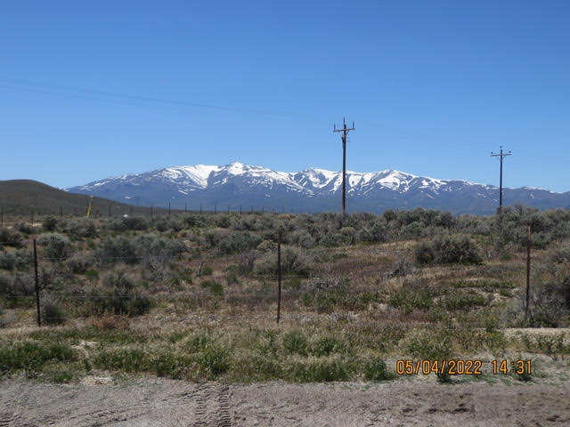
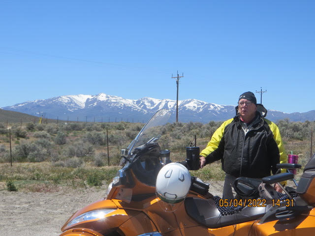
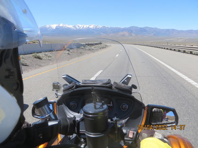
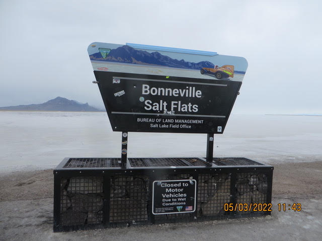
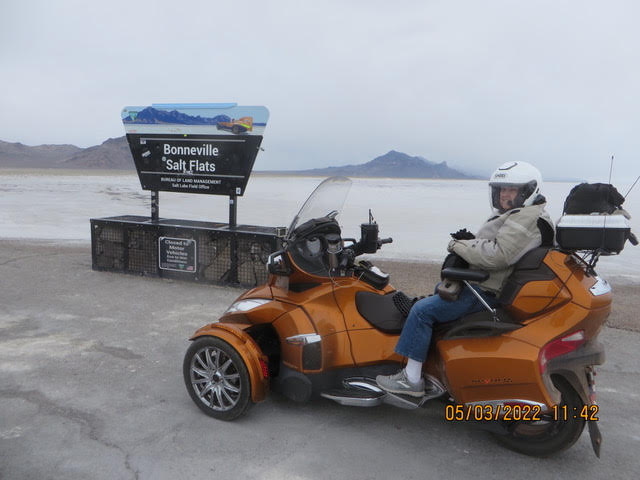
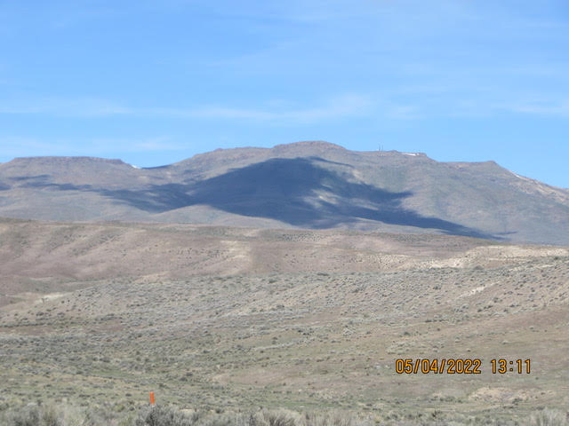
05/03/22 S N O W that’s right Snow
The snow covered Stahl’s. Well, not snow covered but, the Spyder got a taste of what a Ski Do does for a living. It was a cold day for sure, gray overcast damp and then snow washing across the road fortunately the “chain up” signs were off. Road signs telling us that bridges iced up before the road. We rode out to the Bonnaville Salt Flats. Nothing there but a sign. The Spyder wanted to have a go but, the salt was soft….sigh.
We made a bad choice on the route to take west, we should have taken the warmer Las Vegas route rather than the I-80 route. These FL bodies get cold. We had our heated jacket liners, the CanAm with the lining and the rain gear jacket over it all and it was still cold. We checked into the motel and Karen turned the heat on and huddled in the warm air. The snow hit us on the east side Pequap summit, elevation 5900 ft, it was very cold, next a lite mist in the air. Over cast all day…depressing. If it were sunny it wouldn’t have been so bad. I think we took one picture at the Salt Flats and we forgot to bring the camera from the bike and I not running outside to get. Dinner – Wendy’s Chili and a bacon & cheese baked potato. Hot shower and jump under the covers….Here is an old one. The shivering Stahl’s
5/02/22 – The road to Nevada
Hello from the Great Salt LakeThe Spyder is just across the border in Wendover NV. You can tell it is Nevada because the Casinos are everywhere. They want to get you cash as soon as they can.
The trip to Wendover was fine except for the last 40 miles. The terrain was flat salt beds on both sides of the road. The signs at Tooele UT said no hotels for 100 miles. We were just riding looking at the mountains across the salt flats then all of a sudden a cross wing picked up and then it really cut loose. In Texas the wind sucked the snot out of your nose well, until, the last 40 miles was so strong if you opened your mouth your lips flapped around. 25 mph cross wind.
Wendover is the home of the Bonneville Raceway, the Salt Flats where land speed records are set. The Spyder will visit the site tomorrow. The town was established in 1908 as a station stop on the Western Pacific Railroad, then under construction. The transcontinental telephone line was completed as workers raised the final pole at Wendover, Utah on June 27, 1914, after construction of 3,400 miles (5,500 km) of telephone line. However, the line was not utilized until January 25, 1915, when the first transcontinental telephone call was made to coincide with the opening of the Panama Pacific Exposition. During World War II, the nearby Wendover Army Air Field(later known as the Wendover Air Force Base) was a training base for bomber pilots, including the crew of the Enola Gay. The Enola Gay was stationed here until June 1945.Tooele UT, (pronounced To-Will-a) is the home of Rio Tinto-Kennecott Copper. Copper ore from the Bingham Canyon mine has been processed here since 1903. There are 5 companies harvesting salt from the Great Salt lake. Each company pays royalties to the state of Utah. Table salt is not produced here. We passed a Morton Salt plant along I-80. We could see small “snow drifts” of salt along the highway. Here are a few pictures. The wind blown travelers .John and Karen

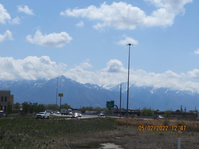
5/01/22 – It was a cold road to Provo UT
Hello from the Beehive State. The Spyder is resting in Springville UT Judy south of Provo. The ride from Green River wasn’t too bad until we started up the Wasatch over the Soldier summit on route 6. It was cold at 7500 feet with no sun fortunately the jacket hears kept us warm. The road wound around the mountain valleys and up over peaks, great scenery. The road followed a railroad pretty much all the way. The railroads was 2 tracked and at times 3 tracks, there were dual tunnels through the mountain and the road went over the top. I had hoped to see a train climbing or descending as we travelled but, none. Green River has a long history of oil and gas production . The Green River Formatting was thought to have the worlds largest deposit of oil shale. It is estimated to have 500 billion to 1.1 trillion recoverable barrels of oil. The cost of recovery is high and therefore not really economical.
The Green River Basin contains the world’s largest known deposit of trona ore near Green River, Wyoming. Soda ash mining from trona veins 900 and 1600 feet (300 and 500 m) deep is a major industrial activity in the area, employing over 2000 persons at four mines. The mining operation is less expensive for production of soda ash in the United States than the synthetic Solvay process, which predominates in the rest of the world. Crossing the Wasatch mountains still have snow on them, white fingers on the mountains. Tomorrow we head west on I-80, I’m not sure how far we will go as it all depends on where we can find lodging, it might be a short day.
There is snow on the mountain behind the clouds
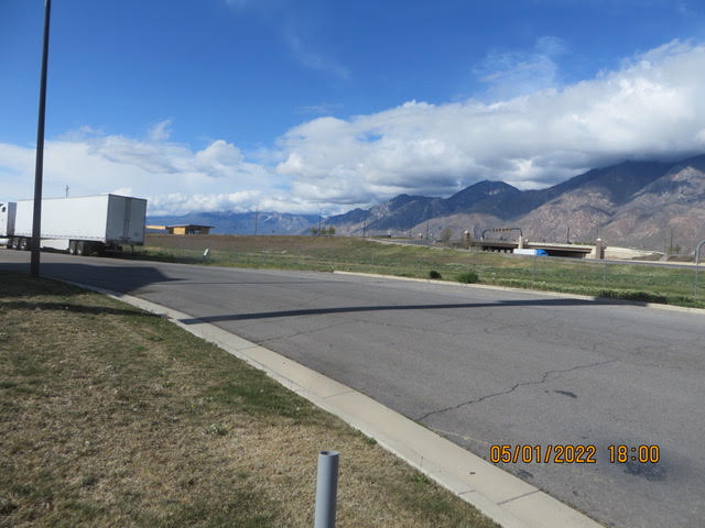
4/30/22 – Moab
Hello from Green River UT,Route changes they are a coming. The Stahl’s are not going to Petersburg AK. The Harris’s are are leaving for the lower 48 at the same time we had intended to be there. It was too much for Karen and Zach to get ready for their trip and have visitors at the same time.
The red dust covered Spyder left Mexican Hat and headed north through Moab and ended up in Green River UT for the night. We changed our route heading for Lake Tahoe via I-80. We did it because we we travel about 200 miles per day hence choosing I-80 will have more places to stop for the night. The other routes across Nevada looked a bit iffy finding places to stay.
Back to the ride to Moab. We had breakfast at Twin Rocks Cafe in Bluff, UT. They were out of Navaho Blue Corn Pancakes. Western Omelet filled the bill. I did buy a bag of Blue Corn flour including the recipe for the pancakes. The picture will explain the name.
Route 191 took us through amazing formations, everywhere you looked was an OMG moment. There were Campers set up everywhere with an ATV of a Jeep or an off the road vehicle beside it. This off the road vehicle mecca. Mountain bikes and dirt bike trails were everywhere. Dust covered vehicles and riders!The town of Moab was busy, trucks towing a trailer with and ATV. You can rent an ATV on just about every corner. It is the “season” here. Oh, I forgot to mention there was a couple pedaling up the Moki Dugway Road, yes UP.
Here are a few pictures. John and Karen
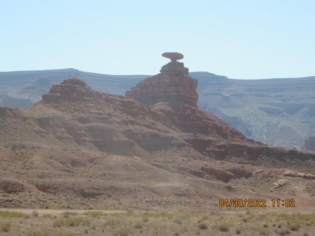
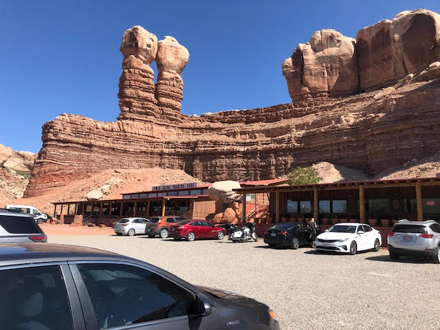
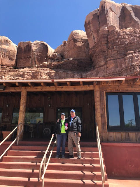
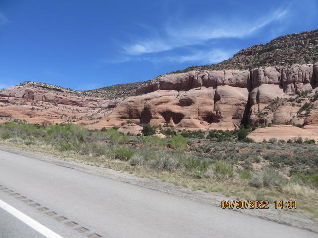
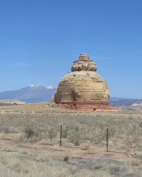

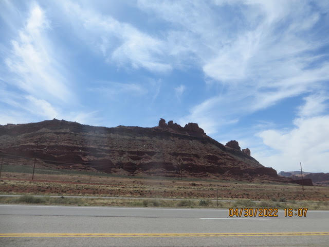
4/29/22 – Moki Dugway Road
The off roading Spyder.
The Spyder left Blanding UT in the morning heading for the Moki Dugway Road. The road leading to the interesting part of the roads headed out across the mesa relatively flat straight without any excitement. Then the signs started warning us that 3 miles of steep winding road, 10% grade gravel road. It was worth it, definitely OMG, what a view, 1000 feet essentially straight down with switch backs. No guard rail. It is said not for the “faint of heart”. Next the Valley of the Gods, now that was the “off the road” part. It was better suited to Subaru Outback or a Jeep or a CanAm 4 wheeler. The Spyder driver had to pick his way over rocks holes ruts and dry washes. Oh, wash board surfaces, I was not going to say wash board road. The views were extraordinary the mesas, the standing rock formations, amazing. Karen kept asking where does this “road” lead us. We bedded down in Mexican Hat and there is a rock formation that looks like a Mexican hat. Mexican Hat is on the San Juan river.
Mexican Hat is a census-designated place (CDP) in Utah in the United States. It is on the San Juan River on the northern edge of the Navajo Nation‘s borders in south-central San Juan County. The population was 31 in the 2010 census, a sharp decline from the previous two censuses. The name “Mexican Hat” comes from a curiously sombrero-shaped rock outcropping on the northeast edge of town; the rock measures 60-foot (18 m) wide by 12-foot (3.7 m). The “Hat” has two rock climbing routes ascending it. Mexican Hat has frequently been noted on lists of unusual place names.
[3]In 2016, the U.S. Route 163 bridge crossing the San Juan River on the south border of the town was renamed the “Jason R. Workman Memorial Bridge” after a member of SEAL Team Six who was killed in action in Afghanistan on August 6, 2011. Workman was a 1997 graduate of the nearby San Juan High School.[4]The Valley of the Gods may be toured via a 17-mile (27 km) gravel road (San Juan County Road 242) that winds around the formations. The road is rather steep and bumpy in parts but is passable by non-four-wheel drive vehicles in dry weather. The western end joins Utah State Route 261 shortly before its 1,200-foot (370 m) ascent up Cedar Mesa at Moki Dugway, while the eastern end starts nine miles (14 km) from the town of Mexican Hat along U.S. Route 163 and heads north, initially crossing flat, open land and following the course of Lime Creek, a seasonal wash, before turning west toward the buttes and pinnacles.[1] In addition to the gravel road, the area is also crisscrossed by off-road dirt trails.The valley is public land managed by the Bureau of Land Management. No entrance fee is charged and no services are provided in the valley. Dispersed camping is permitted at previously disturbed sites, though campfires are not allowed.
Now for a few pictures….The Moki Dugway road
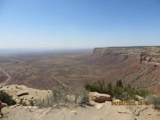
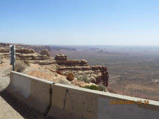
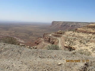
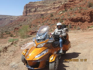
4/28/22 – The road to Blanding
Hello, from the gateway to Utah’s Natl Parks, The Spyder left Farmington NM heading toward Shiprock NM. Shiprock is named for the up-thrust rock formation jutting up from the relatively flat terrain that looks like a sailing ship. We headed north on the way to Blanding passing through beautiful mesas and buttes on either side of the road on the road toward Cortez NM. Then on RT 160 then on a bumpy road through Aneth on the way to Blanding. It was a butt test for sure.
Blanding (/ˈblændɪŋ/ (listen)) is a city in San Juan County, Utah, United States. The population was 3,375 at the 2010 census, making it the most populated city in San Juan County. It was settled in the late 19th century by Mormon settlers, predominantly from the famed Hole-In-The-Rock expedition. Economic contributors include mineral processing, mining, agriculture, local commerce, tourism, and transportation. Blanding is located near both the Navajo and White Mesa Ute Native American reservations, and a significant percentage of Blanding’s population has family ties to these nearby cultures. Blanding is a gateway to an abundance of nearby natural and archaeological resources, including The Dinosaur Museum, Natural Bridges National Monument, Monument Valley and the Four Corners area, Glen Canyon National Recreation Area (Lake Powell), Cedar Mesa archaeological and wilderness area, the San Juan River including Goosenecks State Park, and the Needles district of Canyonlands National Park. It is located approximately 1 hour south of the popular recreation hub of Moab and Arches National Park. First known as Grayson (after Nellie Grayson Lyman, wife of settler Joseph Lyman), the town changed its name in 1914 when a wealthy easterner, Thomas W. Bicknell, offered a thousand-volume library to any town that would adopt his name. Grayson competed with Thurber, Utah (renamed Bicknell) for the prize. Grayson was renamed Blanding after the maiden name of Bicknell’s wife, and each of the towns received 500 books. From Wikipedia
The streets in Blanding are very wide similar to Salt Lake City. I believe the streets sin Salt lake were laid out so that Brigham Young could turn His Ox drawn carriage around in the street. I was also told that was 4 horse hitch could turn in the street.Tomorrow The Spyder heads for the Moki Dugway road and the Valley of the Gods. Bedding down for the night in Mexican Hat.
Here are a few pictures
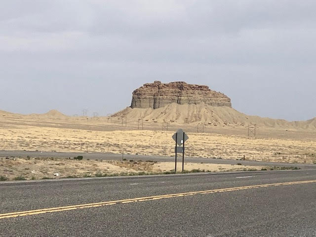
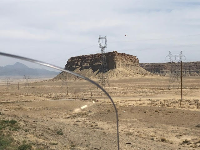
4/27/2022 The road to Farmington
Hello from the wind buffeted Stahl’s. How windy was it, you ask. The cross wind gusts were so strong they “sucked the snot out of your nose”.
We took RT 550 from Albuquerque to Farmington. The first part of the trip to Cuba NM was through rocky canyons and deep washes. The buttes were gorgeous with the colors of the rock sides moving from red to pink to gray depending on the height of the wall. The land was very dry, no water in the streams or washes. We did see a few cattle grazing here and there. Upon leaving Cuba the land was not as abrupt, the mesas were farther away and the wind gusts picked up. A dust devil crossed the road inn front of us. The terrain was continuously changing, wide flat areas broken up by mesas. The oil and gas industry is a big employer around Farmington. The housing around Albuquerque all had a desert theme the colors were tan to red rock colors. The larger homes had the “Adobe” look to them.
Being an “East coaster” being used to green trees and grass, here it is more the grays/red rocks and very little green that we are used too. We are used to Florida’s 80-90-100% humidity, here humidity 11%, 0 inches of rain in the last 24 hours and none expected in the next 10 days Did you know you can smell the rain. Karen and I said we both smelled rain. Within a half mile there were a few drops that evaporated within seconds.
Farmington is located at the junction of the San Juan River, the Animas River, and the La Plata River, and is located on the Colorado Plateau. Farmington is the largest city of San Juan County, one of the geographically largest counties in the United States covering 5,538 square miles (14,340 km2). Farmington is on ‘The Trails of the Ancients” byway. The primary industries of San Juan County are the production of petroleum, natural gas, and coal. Major coal mines are the Navajo and San Juan mines, operated by BHP Billiton 15 to 19 miles (24 to 31 km) southwest of Farmington. The coal mined from the Navajo and San Juan mines is used entirely for fuel for the nearby Four Corners Generating Station and San Juan Generating Station to produce electric power. The area that is now Farmington was settled by Ancestral Pueblo people in the 7th Century. Ruins can be visited at nearby Salmon Ruins and at Aztec Ruins.[6] When the Ancestral Puebloans left the area, the Navajos, Jicarilla Apaches, and Utes moved into the area. A key part of the region was known in Navajo as Tóta’ which means “where three rivers meet”.[7]In 1967, as part of a joint U.S. Government-El Paso Electric operation, an underground nuclear detonation occurred 50 miles (80 km) east of Farmington and about 25 miles (40 km) south of Dulce, New Mexico in present-day Carson National Forest. This pilot project of Operation Plowshare, code-named Project Gasbuggy, was an attempt to fracture a large volume of underground bedrock to make more natural gas available for extraction by gas wells. From Wikipedia Today we extract gas and oil by” Fracking”. Tomorrow, 50 degrees in the morning. BTW, I Had a stuffed sapodilla with green chilies for dinner……..Karen won’t let me breathe on her tonight ….A couple of pictures…
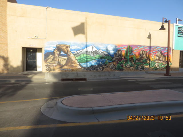
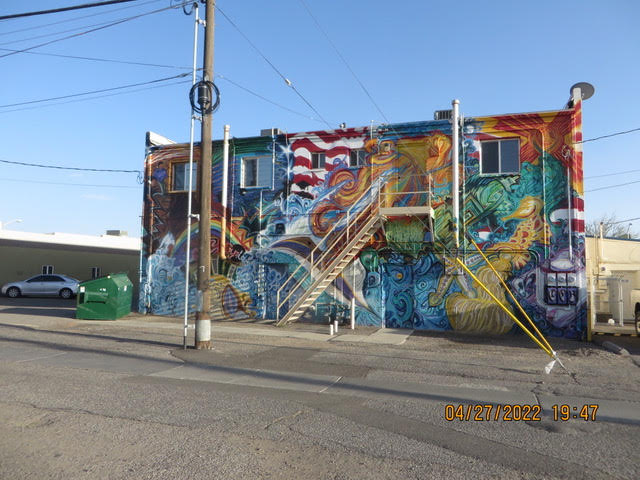

4/26/22 – Lots of empty space
The Spyder are in Albuquerque NM to night. It was a long day on the bike, 288 miles , the longest ride so far. It was windy at times , sunny and bright all day.There’s miles and miles of open land big ranches, brown seats and I believe mesquite trees. A tumble weed ran across the road in front of the Spyder.A friend of mine pointed out that I missed the signature drink of Wichita Falls. I failed to quaff a popular a Red Draw, its popular in the area around the Falls. What is a Red Draw you ask? 12oz Bud draft then add 4oz of Campbell’s tomato juice and served in frosty mug. I doubt that it is served in The Villages. There are not many towns along I-40, fortunately there are Love’s truck stops and Flying J truck stops. I decided to fill up the Spyder at neither of these. I was watching the gas gage and I had more than enough to get to Love’s but, I did a just in case stop. Check out the picture. We had a smell-o-vision event today outside Amarillo, we passed a big cattle feed lot unfortunately the wind was blowing the wrong way. Cattle on the ranches have to work hard eating the dry wild grass growing amid the Mesquite bushes. I certainly understand why ranches are half million to a million acres. We were slowly climbing up a mesa reaching about 7000 ft then I-40 dropped down and we could see mesa’s around us. We didn’t realize that we were on top of one. As we approached Albuquerque the flat land became more mountainous and rocky. The city is in the Rio Grande river valley. The Albuquerque International Balloon Festival hosts the worlds largest number of Hot Air Balloon’s in October. The economy of Albuquerque centers on science, medicine, technology, commerce, education, entertainment, and culture outlets. The city is home to Kirtland AFB, Sandia National Labs. Tomorrow we head to Farmington NM, a ride through the mountains. Just rolling along


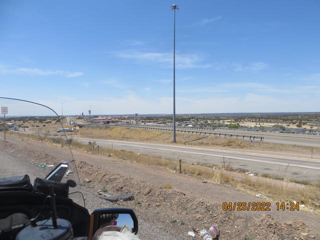
4/25/22 Windy-Cold-Sunny
Hello from Amarillo Texas,“Oklahoma, where the wind comes whistling the plain”…It whistles in Texas but, there not enough syllables in Texas for the song. We buffeted by 25 to 30 mph cross wind gusts pretty much all day. We had the jacket heaters going but, up wind side of our body was cool and the down wind side was nice and warm. Mesquite trees were about all the was to break the wind. They are not very big. They are a legume, their roots fix nitrogen in soil. Their roots can go as deep as 45 ft below the surface and spread 45 ft. Water is scarce in this part of Texas and the mesquite tree is well adapted.
The town of Electra is oil pump jack capital of Texas. The pump jacks were pumping and the wind machines were spinning. Dan Waggoner began ranching here in 1852. His son, Tom lobbied the Fort Worth and Denver Railroad to build the line through here. As area grew there were couple of names for the town fortunately the townspeople voted to change the name to Electra after tom’s daughter.For you Ohioans the is a Chillicothe TX.
Some facts about Amarillo. Amarillo is Spanish for yellow, it was once the self proclaimed Helium capital of the world having the country’s most productive Helium fields. Also Yellow City, Rotor City for it’s V22 Osprey aircraft assembly plant. Amarillo operates one of the largest meat packing plants. Pantex, the only nuclear weapons assembly and disassembly facility in the country, is also a major employer. The location of this facility also gave rise to the nickname “Bomb City.
Tomorrow the Spyder aims itself for Albuquerque NM, it’s quite a haul for us but, we may not have much of a choice, There are not a lot of towns that have motels along I-40. BTW, we saw some long BNSF trains, coal, double stack containers and oil tank cars heading east. 1650 miles so far. We are at about 3500 ft above sea level. We lost all of our spring flowers possibly due to the temperature 42-72F or the 1.5 inches precipitation in April. The grasses are brown and the mesquite is just starting leaf.
Continuing west…John and Karen

4/24/22-Rain out in Wichita Falls!
Hello Vicarious Travelers,
Cold and rainy that is the word for today!
The radar showed a band of rain heading for Wichita Falls, with fingers crossed the Spyder happily hit the road. It didn’t take long before there were tears streaming from it’s eyes. Karen and I donned our Frog Togs jacket and pressed on. It was just a drizzle…then rain and cold next find a motel any motel. Two wet bedraggled Spyder riders checked in hit the room and turned the heat up to 80. Get out of the wet clothes(they are dry now) get under the covers and make ZZZZ’s.
The Texas country side is rolling hills, cattle ranches and scrub trees, nothing big. Once out of Fort Worth, there small towns that seem to be located near truck stops. BNSF rail tracks parallels the road. There was a long coal train with 3 locomotives on the front and another 2 on the end and another long double stack waiting for clearance.
I’m kind of getting used to the frontage road arrangement, if you miss a turn take the next exit and loop back.
We saw the the Wichita Falls, there may be a natural one somewhere, this one looked man made.
It won’t be “Amarillo by morning…” maybe by 3Pm. Tomorrow his supposed to be sunny all day starting out in the 50’s, heated jacket liners will be turned on hight for sure. Elevation is 800 to 900 ft
Enough for now….listening to the thunder.
The waterlogged Stahl’s
4/23/22 – I survived the Dallas Freeways
DFW was busy even on a Saturday.
This is kind of a “catch up” of the last several days. We were on the I-20 most of the time hence no historical info. We stopped in Monroe, LA for lunch at a Chic Fil-A for lunch right at noon. They had order takers outside taking orders. There must have been 8 to 10 people with iPad like devices working the lines. I had never seen this before…efficient
We watched a crop duster spraying a large field. The pilot of Air Tractor airplane was amazing flying 10 feet of the ground then pull up do a pylon type turn and back on the deck for the next pass. That plane must have lot of horse power and lift.
We decided to for go our pie in Pie Town, NM and head directly Farmington, NM then Shiprock, NM. For readers of Tony Hillerman mystery novels about the Navaho Police Dept. you will recognize those towns. For persons who haven’t read Tony Hillerman’s novels, they are great stories. You will learn a lot about the Navaho culture.
The Spyder will head out to Amarillo TX tomorrow. We may have to stop earlier, they are predicting 30% showers in he early morning possibly showers in the after noon. If we get caught out comes the Frog Togs rain gear and press on.
The cross wind has been heavy all day, it didn’t effect the Spyder but, the riders sure felt it.
The Spyder need some fuel so we stopped at the Texas Best Smokehouse filled it’s tank with motion lotion. Karen and I had coffee and Diet Coke. We were not hungry just then butt the BBQ smelled great. Next time we will give it a try. BTW, I never saw so many varieties of Beef Jerky in one place.
The Spyder riders,
John and Karen
4/20/2022 Not Much Happened Today
Hello everyone, That is not the way to start out Great Spyder Adventure! Well, it’s kind’a true. We continued west to though Crestview FL, the historic Main Street and then headed to Niceville, FL down on the coast. Melissa, a former Crestview resident, recommended that we go visit the Air Force Armaments Museum so we headed that way. The Spyder did not stop there but, it is on a Military museums on the Gulf road trip. http://www.afarmamentmuseum.com There are Navy, Air Force, Naval Aircraft Battle Ship row all along the Gulf.
The Spyder is at Tillman’s Corners, Alabama tonight, heading toward Jackson MS tomorrow. I’m not sure there will be many pictures tomorrow. It’s just a traveling day heading toward Vicksburg MS and across “Big Muddy” The Mississippi River. Oh, we did have oh’oh event at lunch, Karen said “where is my purse?” neither of us couldn’t remember where we put it. Standing in the parking lot, let’s call the hotel? Do we ride back back to De Funiak Springs? Finally, check the Spyder side pods, Eureka! Locked up on the motorcycle. When you are 79% of a century you forget.
On the road again tomorrow!
April 19, 2022 – Day 2 of the Great Adventure
Hello from De Funiak Springs FL,Well I thought we might make it to Crestview well we only made it to De Funiak Springs due to sightseeing and small town speed limits on RT 90. There are pretty towns along 90. Let’s start at the beginning. We left the motel with our CanAm jackets with the zip in liners, that lasted for about 5 miles. Stop the bike — get the heated liners underneath the jacket…..Brrr Cold. The square in Madison has the 4 Freedoms monument as well as an historical marker. Across from the square is the Madison County Court House. The court house design style was repeated in several county seats along RT 90.
There are many small towns along the route each with its own style. Monticello had the court house in the center of the square. Each of county seats that had the traditional court house had interesting shops to wander through. We passed through Chattahoochee the location of the Florida State Hospital….Karen would not let me slow down! The next picture stop was the Jim Woodruff dam. The dam was built to control the water levels in the Chattahoochee and Flint rivers. The dam formed Lake Seminole.
Enroll to De Funiak springs we passed through Marianna, Chipley and other small towns. Florida is a long state with beautiful scenery. The land becomes rolling hills in the panhandle. There are caverns to explore, water falls and of course crystal-clear springs. There are over 1000 springs in FL, not all are open to the public. Check out this web site for the public ones. https://floridapanhandle.com/blog/florida-springs/
Tomorrow Crestview and Pensacola!

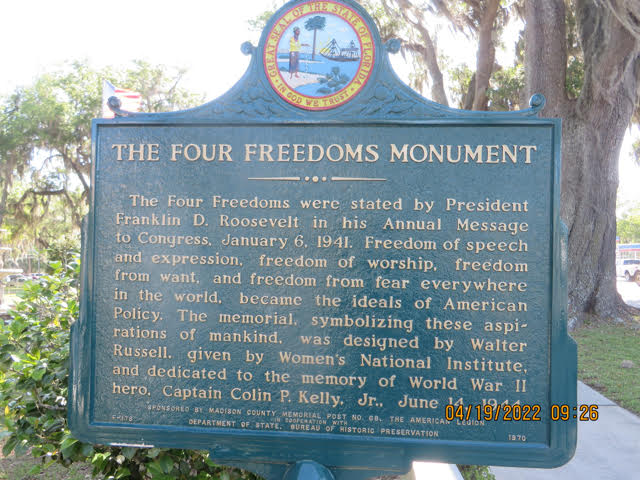
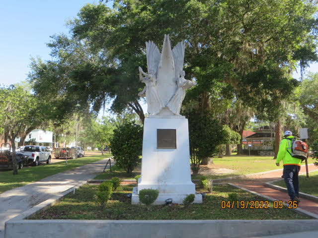
April 18, 2022
Hello everyone,
Karen and I are leaving Monday the 18th for our 3 month Spyder adventure. The trip will take us to the west coast, Alaska, the northern states, MN and WI around to PA and them home. We will be visiting friends along the way.
John and Karen